You are here: Home > Network List > II - Global Seismograph Network (GSN - IRIS/IDA) Stations List
> Station WRAB Tennant Creek, NT, Australia > Earthquake Result Viewer
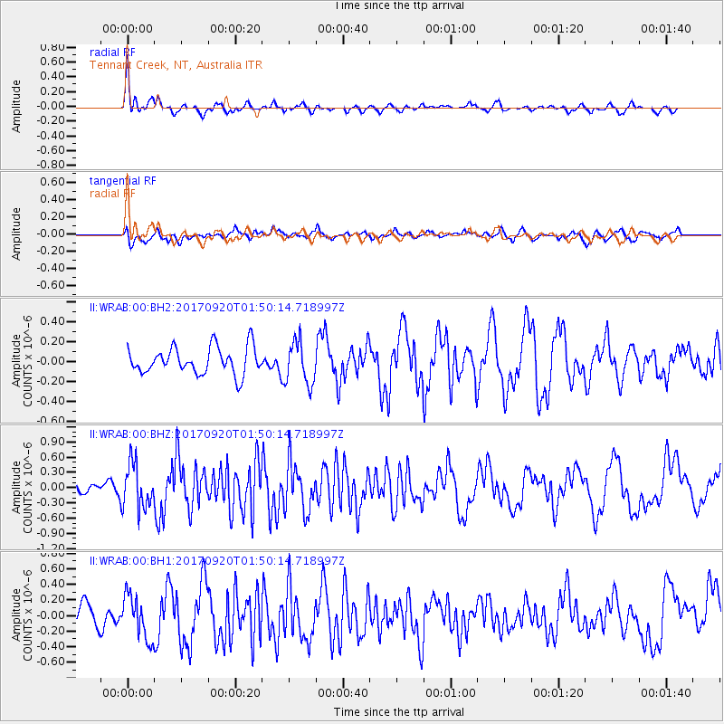
WRAB Tennant Creek, NT, Australia - Earthquake Result Viewer
*The percent match for this event was below the threshold and hence no stack was calculated.
| Earthquake location: |
Auckland Islands, N.Z. Region |
| Earthquake latitude/longitude: |
-50.4/162.5 |
| Earthquake time(UTC): |
2017/09/20 (263) 01:43:30 GMT |
| Earthquake Depth: |
10 km |
| Earthquake Magnitude: |
6.1 Mww |
| Earthquake Catalog/Contributor: |
NEIC PDE/us |
|
| Network: |
II Global Seismograph Network (GSN - IRIS/IDA) |
| Station: |
WRAB Tennant Creek, NT, Australia |
| Lat/Lon: |
19.93 S/134.36 E |
| Elevation: |
366 m |
|
| Distance: |
37.7 deg |
| Az: |
313.373 deg |
| Baz: |
150.347 deg |
| Ray Param: |
$rayparam |
*The percent match for this event was below the threshold and hence was not used in the summary stack. |
|
| Radial Match: |
70.64475 % |
| Radial Bump: |
400 |
| Transverse Match: |
51.27622 % |
| Transverse Bump: |
400 |
| SOD ConfigId: |
2341311 |
| Insert Time: |
2017-10-04 02:05:34.775 +0000 |
| GWidth: |
2.5 |
| Max Bumps: |
400 |
| Tol: |
0.001 |
|
Signal To Noise
| Channel | StoN | STA | LTA |
| II:WRAB:00:BHZ:20170920T01:50:14.718997Z | 1.9959036 | 4.4003775E-7 | 2.2047044E-7 |
| II:WRAB:00:BH1:20170920T01:50:14.718997Z | 1.990974 | 2.8652087E-7 | 1.4390992E-7 |
| II:WRAB:00:BH2:20170920T01:50:14.718997Z | 1.6274477 | 2.1788945E-7 | 1.3388414E-7 |
| Arrivals |
| Ps | |
| PpPs | |
| PsPs/PpSs | |


