You are here: Home > Network List > GS - US Geological Survey Networks Stations List
> Station KAN08 Pence Farm, Harper, KS, USA > Earthquake Result Viewer
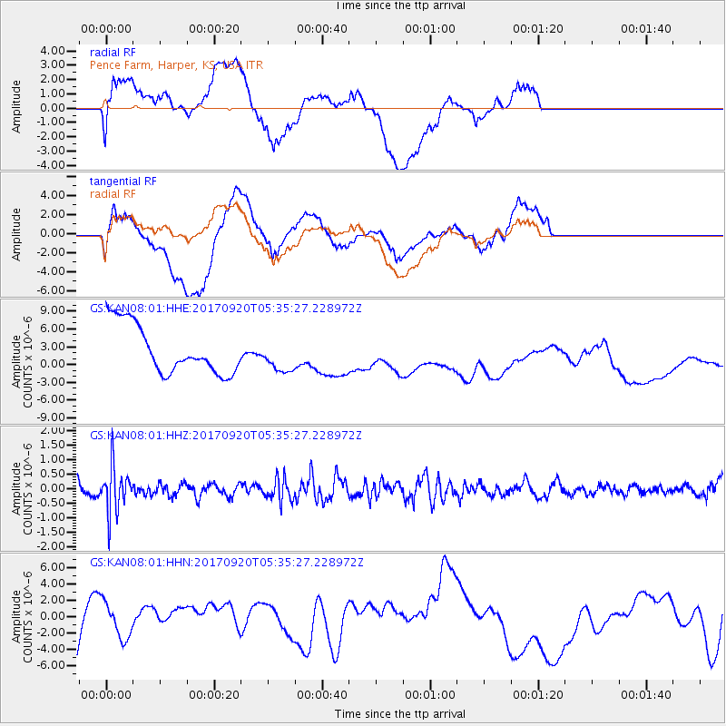
KAN08 Pence Farm, Harper, KS, USA - Earthquake Result Viewer
*The percent match for this event was below the threshold and hence no stack was calculated.
| Earthquake location: |
Southern Peru |
| Earthquake latitude/longitude: |
-16.3/-71.3 |
| Earthquake time(UTC): |
2017/09/20 (263) 05:26:08 GMT |
| Earthquake Depth: |
93 km |
| Earthquake Magnitude: |
5.3 Mww |
| Earthquake Catalog/Contributor: |
NEIC PDE/us |
|
| Network: |
GS US Geological Survey Networks |
| Station: |
KAN08 Pence Farm, Harper, KS, USA |
| Lat/Lon: |
37.23 N/97.97 W |
| Elevation: |
375 m |
|
| Distance: |
58.8 deg |
| Az: |
335.264 deg |
| Baz: |
149.769 deg |
| Ray Param: |
$rayparam |
*The percent match for this event was below the threshold and hence was not used in the summary stack. |
|
| Radial Match: |
41.268707 % |
| Radial Bump: |
400 |
| Transverse Match: |
39.485348 % |
| Transverse Bump: |
400 |
| SOD ConfigId: |
2341311 |
| Insert Time: |
2017-10-04 13:00:56.364 +0000 |
| GWidth: |
2.5 |
| Max Bumps: |
400 |
| Tol: |
0.001 |
|
Signal To Noise
| Channel | StoN | STA | LTA |
| GS:KAN08:01:HHZ:20170920T05:35:27.228972Z | 3.081346 | 8.0107674E-7 | 2.5997625E-7 |
| GS:KAN08:01:HHN:20170920T05:35:27.228972Z | 0.42200053 | 2.32136E-6 | 5.500846E-6 |
| GS:KAN08:01:HHE:20170920T05:35:27.228972Z | 0.6733473 | 2.760599E-6 | 4.0998143E-6 |
| Arrivals |
| Ps | |
| PpPs | |
| PsPs/PpSs | |


