You are here: Home > Network List > GS - US Geological Survey Networks Stations List
> Station KAN13 Rinehart Farm > Earthquake Result Viewer
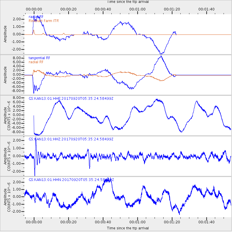
KAN13 Rinehart Farm - Earthquake Result Viewer
*The percent match for this event was below the threshold and hence no stack was calculated.
| Earthquake location: |
Southern Peru |
| Earthquake latitude/longitude: |
-16.3/-71.3 |
| Earthquake time(UTC): |
2017/09/20 (263) 05:26:08 GMT |
| Earthquake Depth: |
93 km |
| Earthquake Magnitude: |
5.3 Mww |
| Earthquake Catalog/Contributor: |
NEIC PDE/us |
|
| Network: |
GS US Geological Survey Networks |
| Station: |
KAN13 Rinehart Farm |
| Lat/Lon: |
37.01 N/97.48 W |
| Elevation: |
340 m |
|
| Distance: |
58.5 deg |
| Az: |
335.538 deg |
| Baz: |
150.208 deg |
| Ray Param: |
$rayparam |
*The percent match for this event was below the threshold and hence was not used in the summary stack. |
|
| Radial Match: |
44.993702 % |
| Radial Bump: |
400 |
| Transverse Match: |
53.813583 % |
| Transverse Bump: |
400 |
| SOD ConfigId: |
2341311 |
| Insert Time: |
2017-10-04 13:01:04.654 +0000 |
| GWidth: |
2.5 |
| Max Bumps: |
400 |
| Tol: |
0.001 |
|
Signal To Noise
| Channel | StoN | STA | LTA |
| GS:KAN13:01:HHZ:20170920T05:35:24.58499Z | 5.5469337 | 9.20703E-7 | 1.6598415E-7 |
| GS:KAN13:01:HHN:20170920T05:35:24.58499Z | 0.34557435 | 3.5897475E-7 | 1.0387772E-6 |
| GS:KAN13:01:HHE:20170920T05:35:24.58499Z | 0.24601623 | 1.2898888E-6 | 5.2431046E-6 |
| Arrivals |
| Ps | |
| PpPs | |
| PsPs/PpSs | |


