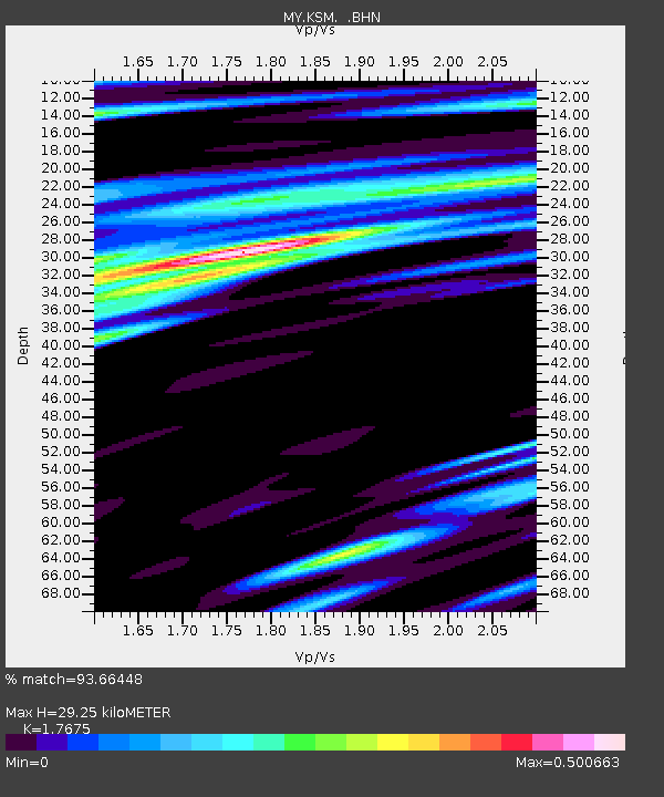
KSM Kuching - Earthquake Result Viewer

Earthquake location: Santa Cruz Islands
Earthquake latitude/longitude: -12.4/166.5
Earthquake time(UTC): 2009/10/12 (285) 09:37:21 GMT
Earthquake Depth: 42 km
Earthquake Magnitude: 5.9 MB, 5.9 MS, 6.2 MW, 6.2 MW
Earthquake Catalog/Contributor: WHDF/NEIC
Network: MY Malaysian National Seismic Network
Station: KSM Kuching
Lat/Lon: 1.47 N/110.31 E
Elevation: 66 m
Distance: 57.5 deg
Az: 279.82 deg
Baz: 105.651 deg
Ray Param: 0.06339416
Estimated Moho Depth: 29.25 km
Estimated Crust Vp/Vs: 1.77
Assumed Crust Vp: 6.468 km/s
Estimated Crust Vs: 3.659 km/s
Estimated Crust Poisson's Ratio: 0.26
Radial Match: 93.66448 %
Radial Bump: 359
Transverse Match: 79.30882 %
Transverse Bump: 400
SOD ConfigId: 2622
Insert Time: 2010-03-09 03:37:41.264 +0000
GWidth: 2.5
Max Bumps: 400
Tol: 0.001

Signal To Noise

ChannelStoNSTALTA
MY:KSM: :BHN:20091012T09:46:35.469014Z14.7295991.5880896E-61.0781621E-7
MY:KSM: :BHE:20091012T09:46:35.469014Z3.57916333.4045675E-79.5121884E-8
MY:KSM: :BHZ:20091012T09:46:35.469014Z7.21219875.8469516E-78.1070304E-8
Arrivals
Ps3.7 SECOND
PpPs12 SECOND
PsPs/PpSs16 SECOND