You are here: Home > Network List > US - United States National Seismic Network Stations List
> Station EGMT Eagleton, Montana, USA > Earthquake Result Viewer
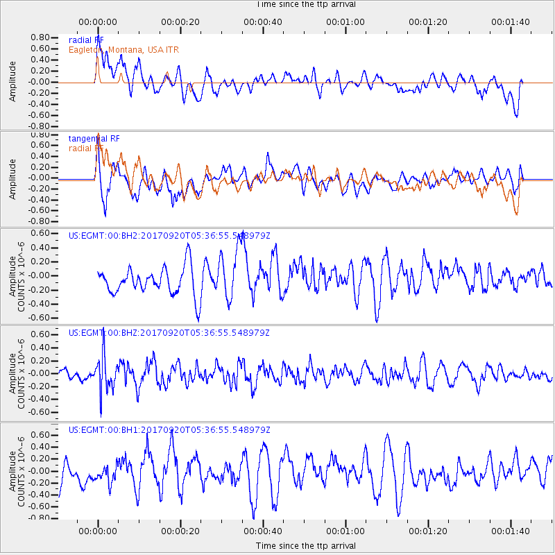
EGMT Eagleton, Montana, USA - Earthquake Result Viewer
*The percent match for this event was below the threshold and hence no stack was calculated.
| Earthquake location: |
Southern Peru |
| Earthquake latitude/longitude: |
-16.3/-71.3 |
| Earthquake time(UTC): |
2017/09/20 (263) 05:26:08 GMT |
| Earthquake Depth: |
93 km |
| Earthquake Magnitude: |
5.3 Mww |
| Earthquake Catalog/Contributor: |
NEIC PDE/us |
|
| Network: |
US United States National Seismic Network |
| Station: |
EGMT Eagleton, Montana, USA |
| Lat/Lon: |
48.02 N/109.75 W |
| Elevation: |
1055 m |
|
| Distance: |
72.6 deg |
| Az: |
334.07 deg |
| Baz: |
141.272 deg |
| Ray Param: |
$rayparam |
*The percent match for this event was below the threshold and hence was not used in the summary stack. |
|
| Radial Match: |
44.26547 % |
| Radial Bump: |
400 |
| Transverse Match: |
55.265717 % |
| Transverse Bump: |
400 |
| SOD ConfigId: |
2341311 |
| Insert Time: |
2017-10-04 13:04:59.315 +0000 |
| GWidth: |
2.5 |
| Max Bumps: |
400 |
| Tol: |
0.001 |
|
Signal To Noise
| Channel | StoN | STA | LTA |
| US:EGMT:00:BHZ:20170920T05:36:55.548979Z | 3.3170452 | 2.6946543E-7 | 8.1236585E-8 |
| US:EGMT:00:BH1:20170920T05:36:55.548979Z | 0.50708413 | 1.5436886E-7 | 3.0442456E-7 |
| US:EGMT:00:BH2:20170920T05:36:55.548979Z | 1.8952812 | 3.7020868E-7 | 1.953318E-7 |
| Arrivals |
| Ps | |
| PpPs | |
| PsPs/PpSs | |


