You are here: Home > Network List > US - United States National Seismic Network Stations List
> Station ERPA Erie, Pennsylvania, USA > Earthquake Result Viewer
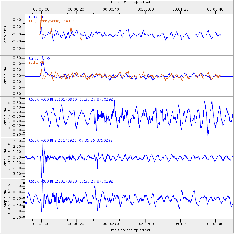
ERPA Erie, Pennsylvania, USA - Earthquake Result Viewer
*The percent match for this event was below the threshold and hence no stack was calculated.
| Earthquake location: |
Southern Peru |
| Earthquake latitude/longitude: |
-16.3/-71.3 |
| Earthquake time(UTC): |
2017/09/20 (263) 05:26:08 GMT |
| Earthquake Depth: |
93 km |
| Earthquake Magnitude: |
5.3 Mww |
| Earthquake Catalog/Contributor: |
NEIC PDE/us |
|
| Network: |
US United States National Seismic Network |
| Station: |
ERPA Erie, Pennsylvania, USA |
| Lat/Lon: |
42.12 N/79.99 W |
| Elevation: |
306 m |
|
| Distance: |
58.6 deg |
| Az: |
352.451 deg |
| Baz: |
170.235 deg |
| Ray Param: |
$rayparam |
*The percent match for this event was below the threshold and hence was not used in the summary stack. |
|
| Radial Match: |
42.384705 % |
| Radial Bump: |
400 |
| Transverse Match: |
76.64798 % |
| Transverse Bump: |
400 |
| SOD ConfigId: |
2341311 |
| Insert Time: |
2017-10-04 13:05:08.886 +0000 |
| GWidth: |
2.5 |
| Max Bumps: |
400 |
| Tol: |
0.001 |
|
Signal To Noise
| Channel | StoN | STA | LTA |
| US:ERPA:00:BHZ:20170920T05:35:25.875029Z | 4.3105125 | 1.1587077E-6 | 2.6880974E-7 |
| US:ERPA:00:BH1:20170920T05:35:25.875029Z | 1.3106573 | 4.9087157E-7 | 3.745232E-7 |
| US:ERPA:00:BH2:20170920T05:35:25.875029Z | 1.0943191 | 2.61042E-7 | 2.3854287E-7 |
| Arrivals |
| Ps | |
| PpPs | |
| PsPs/PpSs | |


