You are here: Home > Network List > US - United States National Seismic Network Stations List
> Station HAWA Hanford, Washington, USA > Earthquake Result Viewer
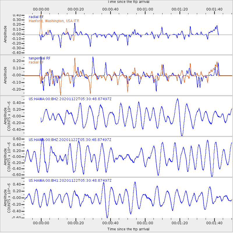
HAWA Hanford, Washington, USA - Earthquake Result Viewer
*The percent match for this event was below the threshold and hence no stack was calculated.
| Earthquake location: |
Fiji Islands Region |
| Earthquake latitude/longitude: |
-16.8/174.4 |
| Earthquake time(UTC): |
2020/11/22 (327) 05:18:37 GMT |
| Earthquake Depth: |
10 km |
| Earthquake Magnitude: |
5.5 Mww |
| Earthquake Catalog/Contributor: |
NEIC PDE/us |
|
| Network: |
US United States National Seismic Network |
| Station: |
HAWA Hanford, Washington, USA |
| Lat/Lon: |
46.39 N/119.53 W |
| Elevation: |
364 m |
|
| Distance: |
86.4 deg |
| Az: |
39.319 deg |
| Baz: |
241.275 deg |
| Ray Param: |
$rayparam |
*The percent match for this event was below the threshold and hence was not used in the summary stack. |
|
| Radial Match: |
51.317165 % |
| Radial Bump: |
383 |
| Transverse Match: |
64.665565 % |
| Transverse Bump: |
400 |
| SOD ConfigId: |
23341671 |
| Insert Time: |
2020-12-06 06:31:13.105 +0000 |
| GWidth: |
2.5 |
| Max Bumps: |
400 |
| Tol: |
0.001 |
|
Signal To Noise
| Channel | StoN | STA | LTA |
| US:HAWA:00:BHZ:20201122T05:30:48.87497Z | 1.575848 | 3.7384967E-7 | 2.3723713E-7 |
| US:HAWA:00:BH1:20201122T05:30:48.87497Z | 1.2325323 | 1.5796454E-7 | 1.281626E-7 |
| US:HAWA:00:BH2:20201122T05:30:48.87497Z | 1.5643938 | 2.4065463E-7 | 1.538325E-7 |
| Arrivals |
| Ps | |
| PpPs | |
| PsPs/PpSs | |


