You are here: Home > Network List > US - United States National Seismic Network Stations List
> Station WUAZ Wupatki, Arizona, USA > Earthquake Result Viewer
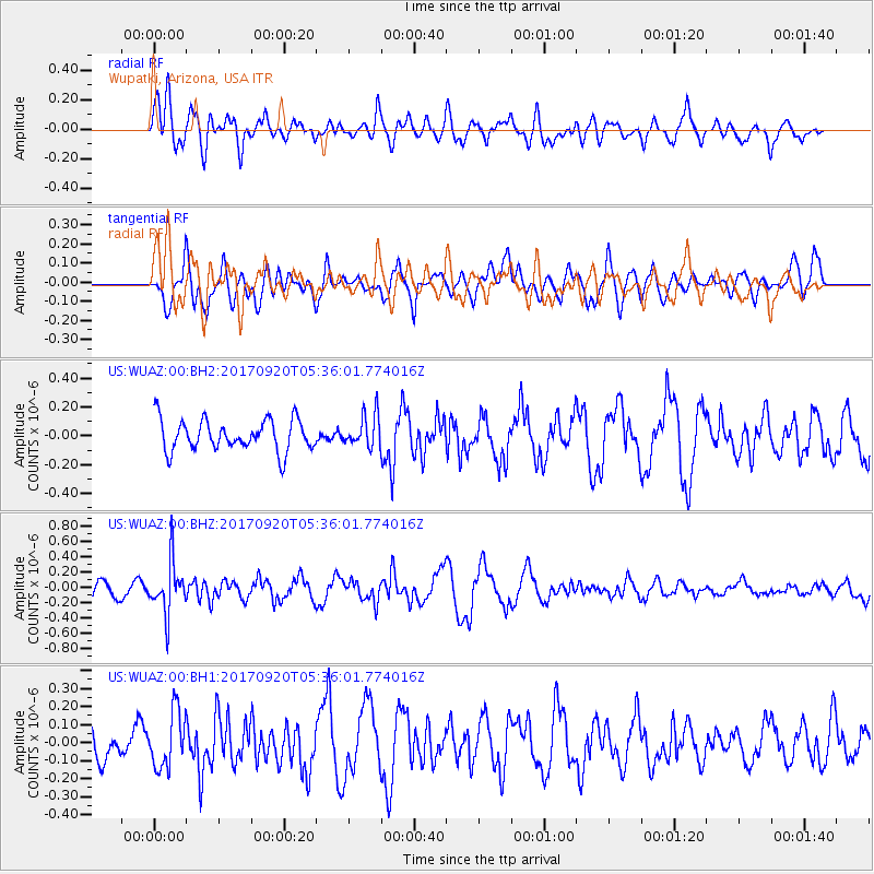
WUAZ Wupatki, Arizona, USA - Earthquake Result Viewer
*The percent match for this event was below the threshold and hence no stack was calculated.
| Earthquake location: |
Southern Peru |
| Earthquake latitude/longitude: |
-16.3/-71.3 |
| Earthquake time(UTC): |
2017/09/20 (263) 05:26:08 GMT |
| Earthquake Depth: |
93 km |
| Earthquake Magnitude: |
5.3 Mww |
| Earthquake Catalog/Contributor: |
NEIC PDE/us |
|
| Network: |
US United States National Seismic Network |
| Station: |
WUAZ Wupatki, Arizona, USA |
| Lat/Lon: |
35.52 N/111.37 W |
| Elevation: |
1592 m |
|
| Distance: |
64.0 deg |
| Az: |
324.253 deg |
| Baz: |
136.545 deg |
| Ray Param: |
$rayparam |
*The percent match for this event was below the threshold and hence was not used in the summary stack. |
|
| Radial Match: |
62.919327 % |
| Radial Bump: |
400 |
| Transverse Match: |
58.710552 % |
| Transverse Bump: |
400 |
| SOD ConfigId: |
2341311 |
| Insert Time: |
2017-10-04 13:06:20.938 +0000 |
| GWidth: |
2.5 |
| Max Bumps: |
400 |
| Tol: |
0.001 |
|
Signal To Noise
| Channel | StoN | STA | LTA |
| US:WUAZ:00:BHZ:20170920T05:36:01.774016Z | 3.1758015 | 3.3150747E-7 | 1.0438545E-7 |
| US:WUAZ:00:BH1:20170920T05:36:01.774016Z | 1.0437199 | 1.5547546E-7 | 1.4896284E-7 |
| US:WUAZ:00:BH2:20170920T05:36:01.774016Z | 1.0329553 | 1.11570984E-7 | 1.08011434E-7 |
| Arrivals |
| Ps | |
| PpPs | |
| PsPs/PpSs | |


