You are here: Home > Network List > TA - USArray Transportable Network (new EarthScope stations) Stations List
> Station H31M Peel River, Yukon, CAN > Earthquake Result Viewer
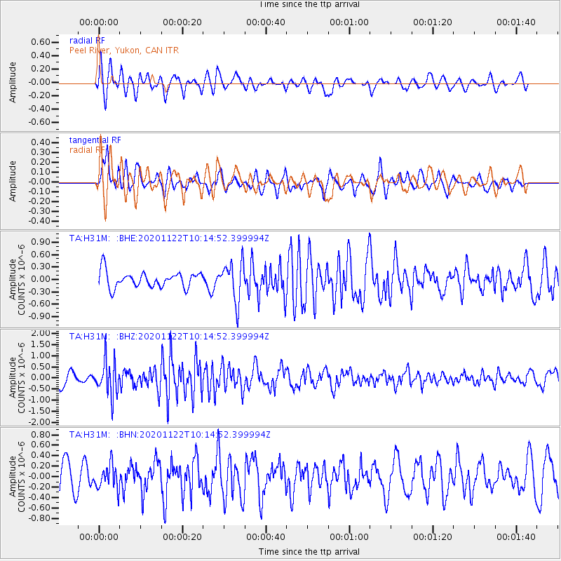
H31M Peel River, Yukon, CAN - Earthquake Result Viewer
*The percent match for this event was below the threshold and hence no stack was calculated.
| Earthquake location: |
Near East Coast Of Honshu, Japan |
| Earthquake latitude/longitude: |
36.6/141.1 |
| Earthquake time(UTC): |
2020/11/22 (327) 10:05:54 GMT |
| Earthquake Depth: |
35 km |
| Earthquake Magnitude: |
5.5 Mww |
| Earthquake Catalog/Contributor: |
NEIC PDE/us |
|
| Network: |
TA USArray Transportable Network (new EarthScope stations) |
| Station: |
H31M Peel River, Yukon, CAN |
| Lat/Lon: |
65.81 N/134.34 W |
| Elevation: |
642 m |
|
| Distance: |
55.1 deg |
| Az: |
30.012 deg |
| Baz: |
282.351 deg |
| Ray Param: |
$rayparam |
*The percent match for this event was below the threshold and hence was not used in the summary stack. |
|
| Radial Match: |
66.11786 % |
| Radial Bump: |
400 |
| Transverse Match: |
67.067856 % |
| Transverse Bump: |
400 |
| SOD ConfigId: |
23341671 |
| Insert Time: |
2020-12-06 11:22:36.797 +0000 |
| GWidth: |
2.5 |
| Max Bumps: |
400 |
| Tol: |
0.001 |
|
Signal To Noise
| Channel | StoN | STA | LTA |
| TA:H31M: :BHZ:20201122T10:14:52.399994Z | 2.5628316 | 7.7428604E-7 | 3.0212132E-7 |
| TA:H31M: :BHN:20201122T10:14:52.399994Z | 0.91284704 | 2.3640956E-7 | 2.5898046E-7 |
| TA:H31M: :BHE:20201122T10:14:52.399994Z | 2.5071828 | 4.836373E-7 | 1.9290069E-7 |
| Arrivals |
| Ps | |
| PpPs | |
| PsPs/PpSs | |


