You are here: Home > Network List > UU - University of Utah Regional Network Stations List
> Station CCUT Cedar City, UT, USA > Earthquake Result Viewer
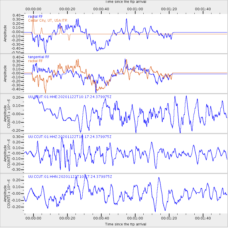
CCUT Cedar City, UT, USA - Earthquake Result Viewer
*The percent match for this event was below the threshold and hence no stack was calculated.
| Earthquake location: |
Near East Coast Of Honshu, Japan |
| Earthquake latitude/longitude: |
36.6/141.1 |
| Earthquake time(UTC): |
2020/11/22 (327) 10:05:54 GMT |
| Earthquake Depth: |
35 km |
| Earthquake Magnitude: |
5.5 Mww |
| Earthquake Catalog/Contributor: |
NEIC PDE/us |
|
| Network: |
UU University of Utah Regional Network |
| Station: |
CCUT Cedar City, UT, USA |
| Lat/Lon: |
37.55 N/113.36 W |
| Elevation: |
2127 m |
|
| Distance: |
79.1 deg |
| Az: |
51.221 deg |
| Baz: |
307.862 deg |
| Ray Param: |
$rayparam |
*The percent match for this event was below the threshold and hence was not used in the summary stack. |
|
| Radial Match: |
57.668484 % |
| Radial Bump: |
400 |
| Transverse Match: |
59.91299 % |
| Transverse Bump: |
400 |
| SOD ConfigId: |
23341671 |
| Insert Time: |
2020-12-06 11:24:43.422 +0000 |
| GWidth: |
2.5 |
| Max Bumps: |
400 |
| Tol: |
0.001 |
|
Signal To Noise
| Channel | StoN | STA | LTA |
| UU:CCUT:01:HHZ:20201122T10:17:24.379975Z | 1.1752919 | 9.390344E-8 | 7.989797E-8 |
| UU:CCUT:01:HHN:20201122T10:17:24.379975Z | 0.59289366 | 4.094368E-8 | 6.905737E-8 |
| UU:CCUT:01:HHE:20201122T10:17:24.379975Z | 1.2297513 | 1.147318E-7 | 9.329674E-8 |
| Arrivals |
| Ps | |
| PpPs | |
| PsPs/PpSs | |


