You are here: Home > Network List > CN - Canadian National Seismograph Network Stations List
> Station INK INUVIK, NT > Earthquake Result Viewer
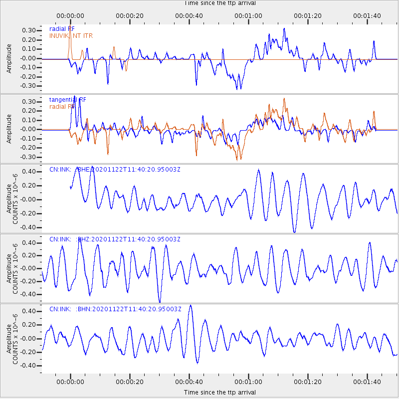
INK INUVIK, NT - Earthquake Result Viewer
*The percent match for this event was below the threshold and hence no stack was calculated.
| Earthquake location: |
Ceram Sea |
| Earthquake latitude/longitude: |
-2.6/127.5 |
| Earthquake time(UTC): |
2020/11/22 (327) 11:27:26 GMT |
| Earthquake Depth: |
11 km |
| Earthquake Magnitude: |
5.3 Mww |
| Earthquake Catalog/Contributor: |
NEIC PDE/us |
|
| Network: |
CN Canadian National Seismograph Network |
| Station: |
INK INUVIK, NT |
| Lat/Lon: |
68.31 N/133.53 W |
| Elevation: |
44 m |
|
| Distance: |
95.7 deg |
| Az: |
21.657 deg |
| Baz: |
277.415 deg |
| Ray Param: |
$rayparam |
*The percent match for this event was below the threshold and hence was not used in the summary stack. |
|
| Radial Match: |
52.507217 % |
| Radial Bump: |
400 |
| Transverse Match: |
47.430122 % |
| Transverse Bump: |
400 |
| SOD ConfigId: |
23341671 |
| Insert Time: |
2020-12-06 12:31:04.263 +0000 |
| GWidth: |
2.5 |
| Max Bumps: |
400 |
| Tol: |
0.001 |
|
Signal To Noise
| Channel | StoN | STA | LTA |
| CN:INK: :BHZ:20201122T11:40:20.95003Z | 2.6936388 | 2.8035984E-7 | 1.0408219E-7 |
| CN:INK: :BHN:20201122T11:40:20.95003Z | 0.8590117 | 1.1870906E-7 | 1.381926E-7 |
| CN:INK: :BHE:20201122T11:40:20.95003Z | 1.0684551 | 1.8600775E-7 | 1.7409037E-7 |
| Arrivals |
| Ps | |
| PpPs | |
| PsPs/PpSs | |


