You are here: Home > Network List > TA - USArray Transportable Network (new EarthScope stations) Stations List
> Station F26K Sheenjek River, AK, USA > Earthquake Result Viewer
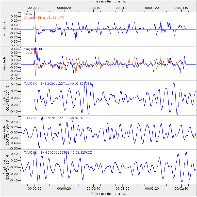
F26K Sheenjek River, AK, USA - Earthquake Result Viewer
*The percent match for this event was below the threshold and hence no stack was calculated.
| Earthquake location: |
Ceram Sea |
| Earthquake latitude/longitude: |
-2.6/127.5 |
| Earthquake time(UTC): |
2020/11/22 (327) 11:27:26 GMT |
| Earthquake Depth: |
11 km |
| Earthquake Magnitude: |
5.3 Mww |
| Earthquake Catalog/Contributor: |
NEIC PDE/us |
|
| Network: |
TA USArray Transportable Network (new EarthScope stations) |
| Station: |
F26K Sheenjek River, AK, USA |
| Lat/Lon: |
67.69 N/144.15 W |
| Elevation: |
683 m |
|
| Distance: |
91.8 deg |
| Az: |
22.443 deg |
| Baz: |
267.522 deg |
| Ray Param: |
$rayparam |
*The percent match for this event was below the threshold and hence was not used in the summary stack. |
|
| Radial Match: |
55.015057 % |
| Radial Bump: |
400 |
| Transverse Match: |
68.59112 % |
| Transverse Bump: |
400 |
| SOD ConfigId: |
23341671 |
| Insert Time: |
2020-12-06 12:33:26.934 +0000 |
| GWidth: |
2.5 |
| Max Bumps: |
400 |
| Tol: |
0.001 |
|
Signal To Noise
| Channel | StoN | STA | LTA |
| TA:F26K: :BHZ:20201122T11:40:02.82503Z | 1.548984 | 3.1588198E-7 | 2.039285E-7 |
| TA:F26K: :BHN:20201122T11:40:02.82503Z | 1.9009366 | 3.438655E-7 | 1.8089267E-7 |
| TA:F26K: :BHE:20201122T11:40:02.82503Z | 1.6577619 | 2.9158187E-7 | 1.7588887E-7 |
| Arrivals |
| Ps | |
| PpPs | |
| PsPs/PpSs | |


