You are here: Home > Network List > TA - USArray Transportable Network (new EarthScope stations) Stations List
> Station I30M Mount Dempster, Yukon, CAN > Earthquake Result Viewer
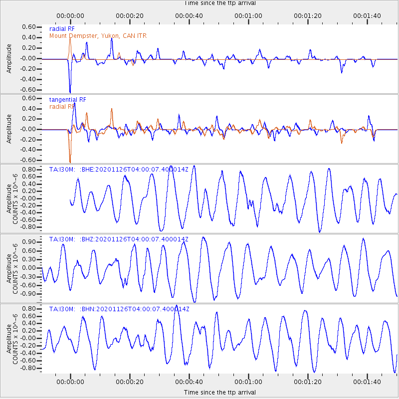
I30M Mount Dempster, Yukon, CAN - Earthquake Result Viewer
*The percent match for this event was below the threshold and hence no stack was calculated.
| Earthquake location: |
Near N Coast Of New Guinea, P.N.G. |
| Earthquake latitude/longitude: |
-4.6/144.9 |
| Earthquake time(UTC): |
2020/11/26 (331) 03:47:45 GMT |
| Earthquake Depth: |
33 km |
| Earthquake Magnitude: |
5.4 Mww |
| Earthquake Catalog/Contributor: |
NEIC PDE/us |
|
| Network: |
TA USArray Transportable Network (new EarthScope stations) |
| Station: |
I30M Mount Dempster, Yukon, CAN |
| Lat/Lon: |
65.22 N/136.38 W |
| Elevation: |
1399 m |
|
| Distance: |
89.5 deg |
| Az: |
24.413 deg |
| Baz: |
257.85 deg |
| Ray Param: |
$rayparam |
*The percent match for this event was below the threshold and hence was not used in the summary stack. |
|
| Radial Match: |
46.020935 % |
| Radial Bump: |
400 |
| Transverse Match: |
71.87753 % |
| Transverse Bump: |
400 |
| SOD ConfigId: |
23341671 |
| Insert Time: |
2020-12-10 04:55:51.530 +0000 |
| GWidth: |
2.5 |
| Max Bumps: |
400 |
| Tol: |
0.001 |
|
Signal To Noise
| Channel | StoN | STA | LTA |
| TA:I30M: :BHZ:20201126T04:00:07.400014Z | 0.6248929 | 3.4313734E-7 | 5.4911385E-7 |
| TA:I30M: :BHN:20201126T04:00:07.400014Z | 1.1052397 | 3.179981E-7 | 2.8771865E-7 |
| TA:I30M: :BHE:20201126T04:00:07.400014Z | 1.9583958 | 6.9449516E-7 | 3.5462452E-7 |
| Arrivals |
| Ps | |
| PpPs | |
| PsPs/PpSs | |


