You are here: Home > Network List > TA - USArray Transportable Network (new EarthScope stations) Stations List
> Station R33M Jennings River, BC, CAN > Earthquake Result Viewer
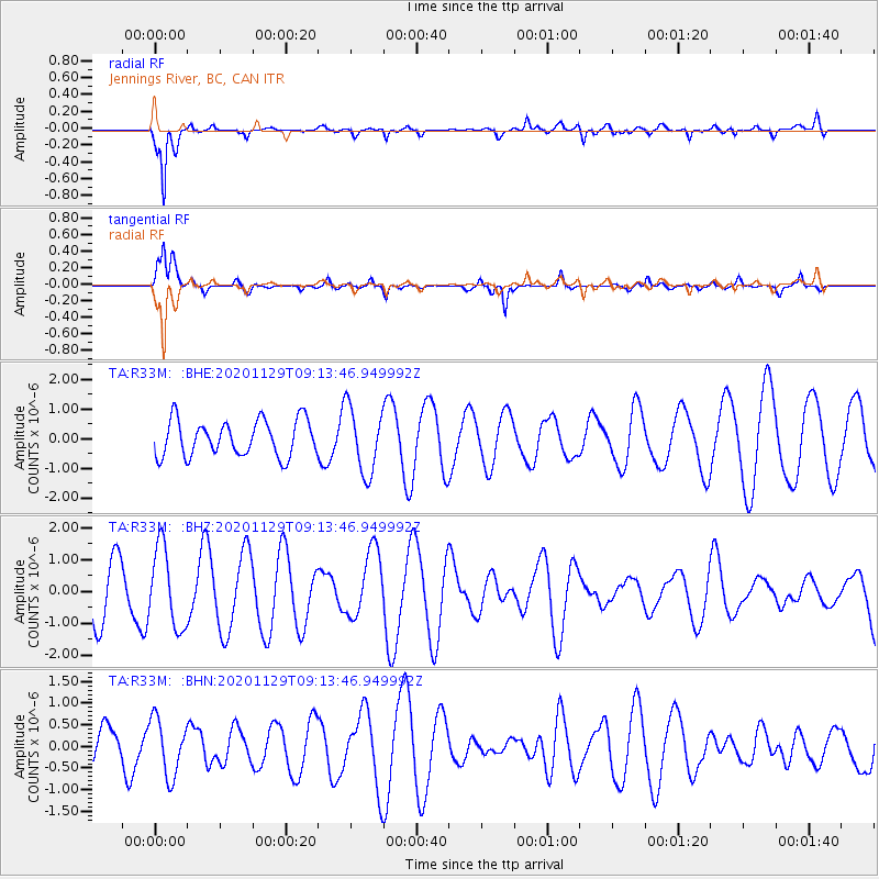
R33M Jennings River, BC, CAN - Earthquake Result Viewer
*The percent match for this event was below the threshold and hence no stack was calculated.
| Earthquake location: |
Vanuatu Islands |
| Earthquake latitude/longitude: |
-14.8/167.3 |
| Earthquake time(UTC): |
2020/11/29 (334) 09:01:35 GMT |
| Earthquake Depth: |
112 km |
| Earthquake Magnitude: |
5.5 mww |
| Earthquake Catalog/Contributor: |
NEIC PDE/us |
|
| Network: |
TA USArray Transportable Network (new EarthScope stations) |
| Station: |
R33M Jennings River, BC, CAN |
| Lat/Lon: |
59.39 N/130.97 W |
| Elevation: |
1437 m |
|
| Distance: |
89.1 deg |
| Az: |
26.799 deg |
| Baz: |
238.455 deg |
| Ray Param: |
$rayparam |
*The percent match for this event was below the threshold and hence was not used in the summary stack. |
|
| Radial Match: |
84.88776 % |
| Radial Bump: |
307 |
| Transverse Match: |
63.562527 % |
| Transverse Bump: |
281 |
| SOD ConfigId: |
23341671 |
| Insert Time: |
2020-12-13 10:12:06.833 +0000 |
| GWidth: |
2.5 |
| Max Bumps: |
400 |
| Tol: |
0.001 |
|
Signal To Noise
| Channel | StoN | STA | LTA |
| TA:R33M: :BHZ:20201129T09:13:46.949992Z | 1.2880437 | 1.2488526E-6 | 9.695732E-7 |
| TA:R33M: :BHN:20201129T09:13:46.949992Z | 0.7216909 | 6.5605343E-7 | 9.0905047E-7 |
| TA:R33M: :BHE:20201129T09:13:46.949992Z | 1.8331335 | 1.1101988E-6 | 6.05629E-7 |
| Arrivals |
| Ps | |
| PpPs | |
| PsPs/PpSs | |


