You are here: Home > Network List > UU - University of Utah Regional Network Stations List
> Station FORU South Mineral Mountains, UT, USA > Earthquake Result Viewer
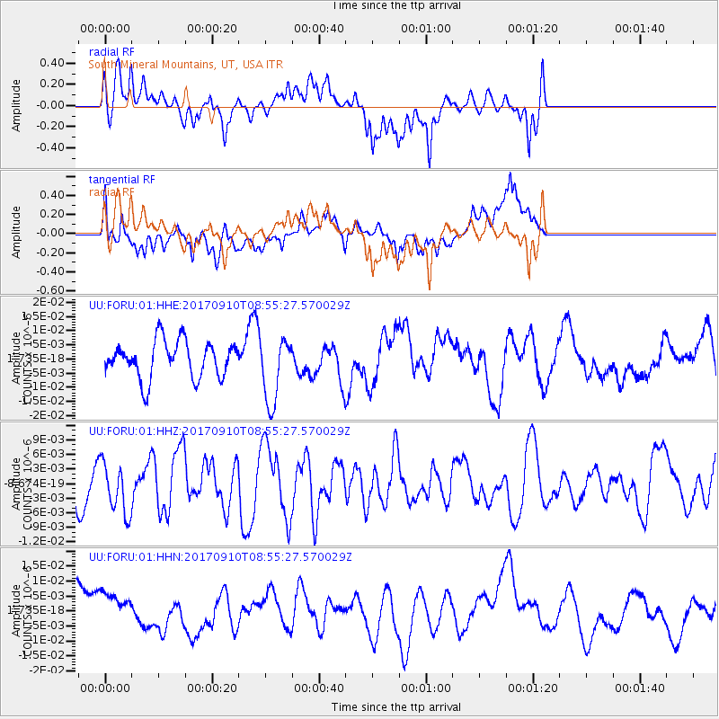
FORU South Mineral Mountains, UT, USA - Earthquake Result Viewer
*The percent match for this event was below the threshold and hence no stack was calculated.
| Earthquake location: |
Hokkaido, Japan Region |
| Earthquake latitude/longitude: |
41.8/142.9 |
| Earthquake time(UTC): |
2017/09/10 (253) 08:44:24 GMT |
| Earthquake Depth: |
45 km |
| Earthquake Magnitude: |
5.5 Mww |
| Earthquake Catalog/Contributor: |
NEIC PDE/us |
|
| Network: |
UU University of Utah Regional Network |
| Station: |
FORU South Mineral Mountains, UT, USA |
| Lat/Lon: |
38.46 N/112.86 W |
| Elevation: |
1840 m |
|
| Distance: |
74.5 deg |
| Az: |
52.142 deg |
| Baz: |
311.223 deg |
| Ray Param: |
$rayparam |
*The percent match for this event was below the threshold and hence was not used in the summary stack. |
|
| Radial Match: |
56.074924 % |
| Radial Bump: |
400 |
| Transverse Match: |
46.854713 % |
| Transverse Bump: |
400 |
| SOD ConfigId: |
2341311 |
| Insert Time: |
2017-10-04 13:46:44.135 +0000 |
| GWidth: |
2.5 |
| Max Bumps: |
400 |
| Tol: |
0.001 |
|
Signal To Noise
| Channel | StoN | STA | LTA |
| UU:FORU:01:HHZ:20170910T08:55:27.570029Z | 1.130858 | 5.1280344E-9 | 4.5346407E-9 |
| UU:FORU:01:HHN:20170910T08:55:27.570029Z | 0.74412477 | 6.165344E-9 | 8.285363E-9 |
| UU:FORU:01:HHE:20170910T08:55:27.570029Z | 1.8022914 | 1.1807413E-8 | 6.551334E-9 |
| Arrivals |
| Ps | |
| PpPs | |
| PsPs/PpSs | |


