You are here: Home > Network List > II - Global Seismograph Network (GSN - IRIS/IDA) Stations List
> Station WRAB Tennant Creek, NT, Australia > Earthquake Result Viewer
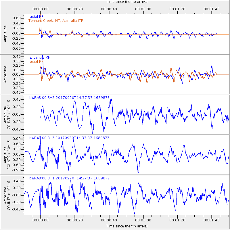
WRAB Tennant Creek, NT, Australia - Earthquake Result Viewer
*The percent match for this event was below the threshold and hence no stack was calculated.
| Earthquake location: |
Taiwan |
| Earthquake latitude/longitude: |
23.3/121.8 |
| Earthquake time(UTC): |
2017/09/20 (263) 14:29:56 GMT |
| Earthquake Depth: |
22 km |
| Earthquake Magnitude: |
5.3 Mww |
| Earthquake Catalog/Contributor: |
NEIC PDE/us |
|
| Network: |
II Global Seismograph Network (GSN - IRIS/IDA) |
| Station: |
WRAB Tennant Creek, NT, Australia |
| Lat/Lon: |
19.93 S/134.36 E |
| Elevation: |
366 m |
|
| Distance: |
44.7 deg |
| Az: |
163.028 deg |
| Baz: |
343.425 deg |
| Ray Param: |
$rayparam |
*The percent match for this event was below the threshold and hence was not used in the summary stack. |
|
| Radial Match: |
64.78029 % |
| Radial Bump: |
400 |
| Transverse Match: |
74.77384 % |
| Transverse Bump: |
400 |
| SOD ConfigId: |
2341311 |
| Insert Time: |
2017-10-04 15:46:54.319 +0000 |
| GWidth: |
2.5 |
| Max Bumps: |
400 |
| Tol: |
0.001 |
|
Signal To Noise
| Channel | StoN | STA | LTA |
| II:WRAB:00:BHZ:20170920T14:37:37.168987Z | 2.6068504 | 4.854728E-7 | 1.8622964E-7 |
| II:WRAB:00:BH1:20170920T14:37:37.168987Z | 1.4825406 | 2.2825924E-7 | 1.5396492E-7 |
| II:WRAB:00:BH2:20170920T14:37:37.168987Z | 1.5484011 | 2.6033283E-7 | 1.681301E-7 |
| Arrivals |
| Ps | |
| PpPs | |
| PsPs/PpSs | |


