You are here: Home > Network List > GS - US Geological Survey Networks Stations List
> Station KAN10 Keim Farm > Earthquake Result Viewer
KAN10 Keim Farm - Earthquake Result Viewer
*The percent match for this event was below the threshold and hence no stack was calculated.
| Earthquake location: |
Off East Coast Of Honshu, Japan |
| Earthquake latitude/longitude: |
38.0/144.7 |
| Earthquake time(UTC): |
2017/09/20 (263) 16:37:16 GMT |
| Earthquake Depth: |
10 km |
| Earthquake Magnitude: |
6.1 Mww |
| Earthquake Catalog/Contributor: |
NEIC PDE/us |
|
| Network: |
GS US Geological Survey Networks |
| Station: |
KAN10 Keim Farm |
| Lat/Lon: |
37.12 N/98.10 W |
| Elevation: |
417 m |
|
| Distance: |
85.5 deg |
| Az: |
45.472 deg |
| Baz: |
315.185 deg |
| Ray Param: |
$rayparam |
*The percent match for this event was below the threshold and hence was not used in the summary stack. |
|
| Radial Match: |
15.062212 % |
| Radial Bump: |
400 |
| Transverse Match: |
20.509838 % |
| Transverse Bump: |
400 |
| SOD ConfigId: |
2341311 |
| Insert Time: |
2017-10-04 18:04:44.587 +0000 |
| GWidth: |
2.5 |
| Max Bumps: |
400 |
| Tol: |
0.001 |
|
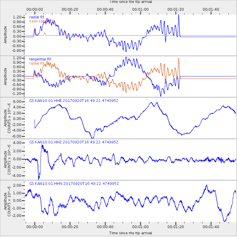
Signal To Noise
| Channel | StoN | STA | LTA |
| GS:KAN10:01:HHZ:20170920T16:49:22.474995Z | 10.108075 | 2.3384525E-6 | 2.3134498E-7 |
| GS:KAN10:01:HHN:20170920T16:49:22.474995Z | 1.5436001 | 8.4453626E-7 | 5.4712115E-7 |
| GS:KAN10:01:HHE:20170920T16:49:22.474995Z | 3.1350782 | 7.036137E-6 | 2.2443257E-6 |
| Arrivals |
| Ps | |
| PpPs | |
| PsPs/PpSs | |


