You are here: Home > Network List > IU - Global Seismograph Network (GSN - IRIS/USGS) Stations List
> Station JOHN Johnston Island, USA > Earthquake Result Viewer
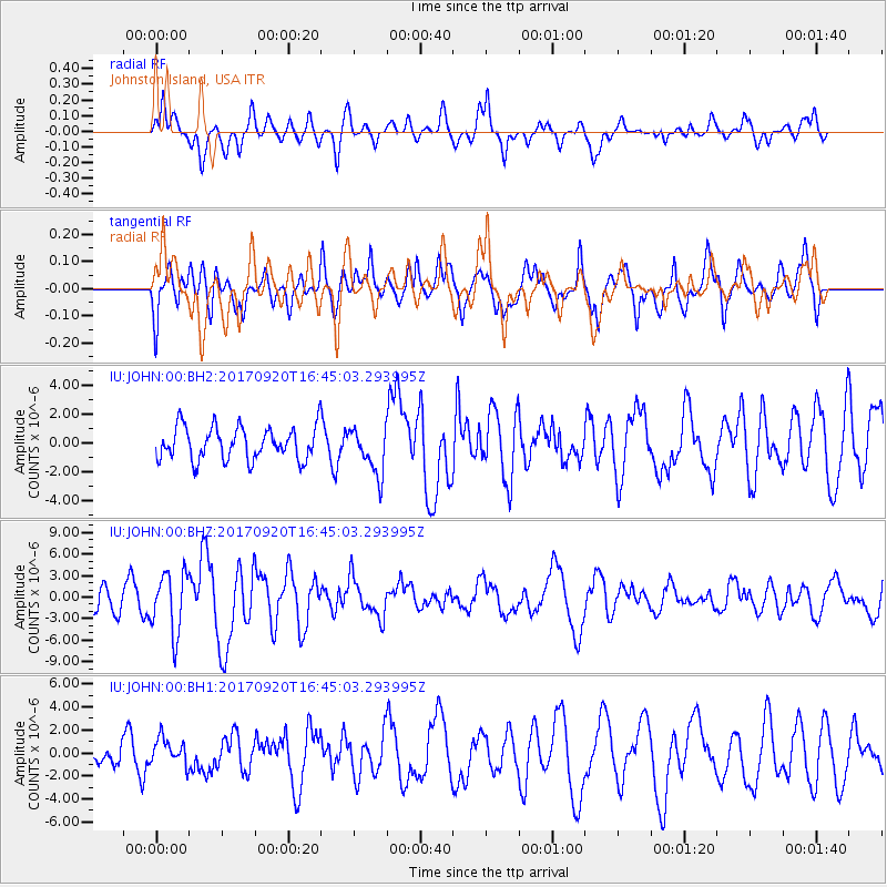
JOHN Johnston Island, USA - Earthquake Result Viewer
*The percent match for this event was below the threshold and hence no stack was calculated.
| Earthquake location: |
Off East Coast Of Honshu, Japan |
| Earthquake latitude/longitude: |
38.0/144.7 |
| Earthquake time(UTC): |
2017/09/20 (263) 16:37:16 GMT |
| Earthquake Depth: |
10 km |
| Earthquake Magnitude: |
6.1 Mww |
| Earthquake Catalog/Contributor: |
NEIC PDE/us |
|
| Network: |
IU Global Seismograph Network (GSN - IRIS/USGS) |
| Station: |
JOHN Johnston Island, USA |
| Lat/Lon: |
16.73 N/169.53 W |
| Elevation: |
2.0 m |
|
| Distance: |
45.3 deg |
| Az: |
104.937 deg |
| Baz: |
307.172 deg |
| Ray Param: |
$rayparam |
*The percent match for this event was below the threshold and hence was not used in the summary stack. |
|
| Radial Match: |
64.59017 % |
| Radial Bump: |
400 |
| Transverse Match: |
61.306297 % |
| Transverse Bump: |
397 |
| SOD ConfigId: |
2341311 |
| Insert Time: |
2017-10-04 18:07:01.011 +0000 |
| GWidth: |
2.5 |
| Max Bumps: |
400 |
| Tol: |
0.001 |
|
Signal To Noise
| Channel | StoN | STA | LTA |
| IU:JOHN:00:BHZ:20170920T16:45:03.293995Z | 2.0844388 | 4.173729E-6 | 2.0023274E-6 |
| IU:JOHN:00:BH1:20170920T16:45:03.293995Z | 0.90305567 | 1.1634756E-6 | 1.2883764E-6 |
| IU:JOHN:00:BH2:20170920T16:45:03.293995Z | 1.397593 | 1.5774406E-6 | 1.1286838E-6 |
| Arrivals |
| Ps | |
| PpPs | |
| PsPs/PpSs | |


