You are here: Home > Network List > US - United States National Seismic Network Stations List
> Station HAWA Hanford, Washington, USA > Earthquake Result Viewer
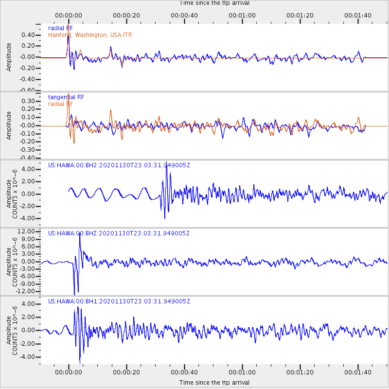
HAWA Hanford, Washington, USA - Earthquake Result Viewer
*The percent match for this event was below the threshold and hence no stack was calculated.
| Earthquake location: |
Primor'ye, Russia |
| Earthquake latitude/longitude: |
48.3/140.8 |
| Earthquake time(UTC): |
2020/11/30 (335) 22:54:34 GMT |
| Earthquake Depth: |
587 km |
| Earthquake Magnitude: |
6.4 mww |
| Earthquake Catalog/Contributor: |
NEIC PDE/us |
|
| Network: |
US United States National Seismic Network |
| Station: |
HAWA Hanford, Washington, USA |
| Lat/Lon: |
46.39 N/119.53 W |
| Elevation: |
364 m |
|
| Distance: |
62.7 deg |
| Az: |
50.19 deg |
| Baz: |
312.126 deg |
| Ray Param: |
$rayparam |
*The percent match for this event was below the threshold and hence was not used in the summary stack. |
|
| Radial Match: |
64.79456 % |
| Radial Bump: |
400 |
| Transverse Match: |
60.091038 % |
| Transverse Bump: |
400 |
| SOD ConfigId: |
23341671 |
| Insert Time: |
2020-12-15 00:30:55.515 +0000 |
| GWidth: |
2.5 |
| Max Bumps: |
400 |
| Tol: |
0.001 |
|
Signal To Noise
| Channel | StoN | STA | LTA |
| US:HAWA:00:BHZ:20201130T23:03:31.949005Z | 8.03082 | 4.7881044E-6 | 5.962161E-7 |
| US:HAWA:00:BH1:20201130T23:03:31.949005Z | 3.3252535 | 1.8447631E-6 | 5.547737E-7 |
| US:HAWA:00:BH2:20201130T23:03:31.949005Z | 3.2251604 | 1.8811078E-6 | 5.832602E-7 |
| Arrivals |
| Ps | |
| PpPs | |
| PsPs/PpSs | |


