You are here: Home > Network List > TA - USArray Transportable Network (new EarthScope stations) Stations List
> Station TUL3 Leonard, OK, USA > Earthquake Result Viewer
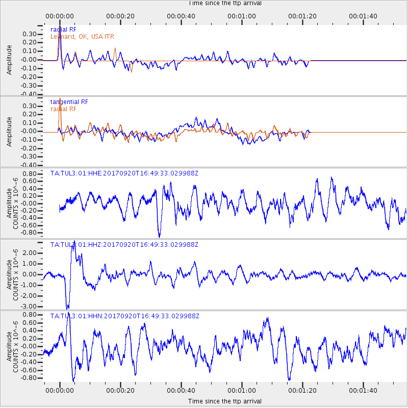
TUL3 Leonard, OK, USA - Earthquake Result Viewer
*The percent match for this event was below the threshold and hence no stack was calculated.
| Earthquake location: |
Off East Coast Of Honshu, Japan |
| Earthquake latitude/longitude: |
38.0/144.7 |
| Earthquake time(UTC): |
2017/09/20 (263) 16:37:16 GMT |
| Earthquake Depth: |
10 km |
| Earthquake Magnitude: |
6.1 Mww |
| Earthquake Catalog/Contributor: |
NEIC PDE/us |
|
| Network: |
TA USArray Transportable Network (new EarthScope stations) |
| Station: |
TUL3 Leonard, OK, USA |
| Lat/Lon: |
35.91 N/95.79 W |
| Elevation: |
265 m |
|
| Distance: |
87.6 deg |
| Az: |
44.983 deg |
| Baz: |
316.521 deg |
| Ray Param: |
$rayparam |
*The percent match for this event was below the threshold and hence was not used in the summary stack. |
|
| Radial Match: |
69.10283 % |
| Radial Bump: |
400 |
| Transverse Match: |
34.252377 % |
| Transverse Bump: |
400 |
| SOD ConfigId: |
2341311 |
| Insert Time: |
2017-10-04 18:10:53.973 +0000 |
| GWidth: |
2.5 |
| Max Bumps: |
400 |
| Tol: |
0.001 |
|
Signal To Noise
| Channel | StoN | STA | LTA |
| TA:TUL3:01:HHZ:20170920T16:49:33.029988Z | 13.510522 | 1.7820541E-6 | 1.319012E-7 |
| TA:TUL3:01:HHN:20170920T16:49:33.029988Z | 2.0734096 | 4.5895496E-7 | 2.2135278E-7 |
| TA:TUL3:01:HHE:20170920T16:49:33.029988Z | 2.3777575 | 4.1034662E-7 | 1.7257715E-7 |
| Arrivals |
| Ps | |
| PpPs | |
| PsPs/PpSs | |


