You are here: Home > Network List > CI - Caltech Regional Seismic Network Stations List
> Station MPM Manuel Prospect Mine, California, USA > Earthquake Result Viewer
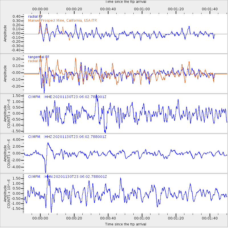
MPM Manuel Prospect Mine, California, USA - Earthquake Result Viewer
*The percent match for this event was below the threshold and hence no stack was calculated.
| Earthquake location: |
Chile-Argentina Border Region |
| Earthquake latitude/longitude: |
-24.4/-67.1 |
| Earthquake time(UTC): |
2020/11/30 (335) 22:54:59 GMT |
| Earthquake Depth: |
148 km |
| Earthquake Magnitude: |
6.3 mww |
| Earthquake Catalog/Contributor: |
NEIC PDE/us |
|
| Network: |
CI Caltech Regional Seismic Network |
| Station: |
MPM Manuel Prospect Mine, California, USA |
| Lat/Lon: |
36.06 N/117.49 W |
| Elevation: |
185 m |
|
| Distance: |
76.7 deg |
| Az: |
320.067 deg |
| Baz: |
133.751 deg |
| Ray Param: |
$rayparam |
*The percent match for this event was below the threshold and hence was not used in the summary stack. |
|
| Radial Match: |
70.28696 % |
| Radial Bump: |
400 |
| Transverse Match: |
60.25657 % |
| Transverse Bump: |
400 |
| SOD ConfigId: |
23341671 |
| Insert Time: |
2020-12-15 00:40:05.327 +0000 |
| GWidth: |
2.5 |
| Max Bumps: |
400 |
| Tol: |
0.001 |
|
Signal To Noise
| Channel | StoN | STA | LTA |
| CI:MPM: :HHZ:20201130T23:06:02.788001Z | 5.79321 | 2.1500916E-6 | 3.7113995E-7 |
| CI:MPM: :HHN:20201130T23:06:02.788001Z | 1.714063 | 7.555466E-7 | 4.4079275E-7 |
| CI:MPM: :HHE:20201130T23:06:02.788001Z | 1.5469328 | 7.124875E-7 | 4.6058076E-7 |
| Arrivals |
| Ps | |
| PpPs | |
| PsPs/PpSs | |


