You are here: Home > Network List > TX - Texas Seismological Network Stations List
> Station WTFS Witchita Falls > Earthquake Result Viewer
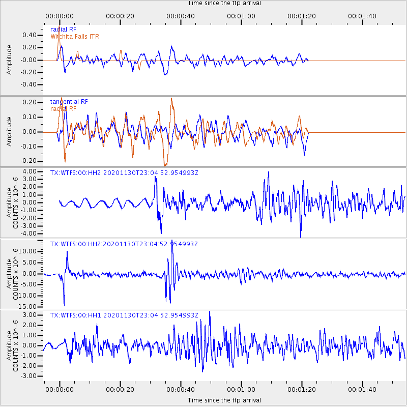
WTFS Witchita Falls - Earthquake Result Viewer
*The percent match for this event was below the threshold and hence no stack was calculated.
| Earthquake location: |
Chile-Argentina Border Region |
| Earthquake latitude/longitude: |
-24.4/-67.1 |
| Earthquake time(UTC): |
2020/11/30 (335) 22:54:59 GMT |
| Earthquake Depth: |
148 km |
| Earthquake Magnitude: |
6.3 mww |
| Earthquake Catalog/Contributor: |
NEIC PDE/us |
|
| Network: |
TX Texas Seismological Network |
| Station: |
WTFS Witchita Falls |
| Lat/Lon: |
33.77 N/98.46 W |
| Elevation: |
277 m |
|
| Distance: |
65.1 deg |
| Az: |
331.4 deg |
| Baz: |
148.399 deg |
| Ray Param: |
$rayparam |
*The percent match for this event was below the threshold and hence was not used in the summary stack. |
|
| Radial Match: |
71.86825 % |
| Radial Bump: |
309 |
| Transverse Match: |
71.71145 % |
| Transverse Bump: |
369 |
| SOD ConfigId: |
23341671 |
| Insert Time: |
2020-12-15 00:58:54.355 +0000 |
| GWidth: |
2.5 |
| Max Bumps: |
400 |
| Tol: |
0.001 |
|
Signal To Noise
| Channel | StoN | STA | LTA |
| TX:WTFS:00:HHZ:20201130T23:04:52.954993Z | 18.442478 | 3.9917327E-6 | 2.164423E-7 |
| TX:WTFS:00:HH1:20201130T23:04:52.954993Z | 2.0800128 | 6.1188626E-7 | 2.9417427E-7 |
| TX:WTFS:00:HH2:20201130T23:04:52.954993Z | 4.8353643 | 1.7192577E-6 | 3.555591E-7 |
| Arrivals |
| Ps | |
| PpPs | |
| PsPs/PpSs | |


