You are here: Home > Network List > US - United States National Seismic Network Stations List
> Station MSO Missoula, Montana, USA > Earthquake Result Viewer
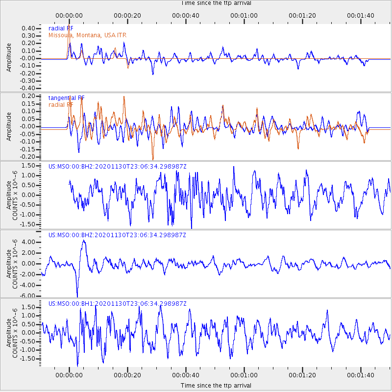
MSO Missoula, Montana, USA - Earthquake Result Viewer
*The percent match for this event was below the threshold and hence no stack was calculated.
| Earthquake location: |
Chile-Argentina Border Region |
| Earthquake latitude/longitude: |
-24.4/-67.1 |
| Earthquake time(UTC): |
2020/11/30 (335) 22:54:59 GMT |
| Earthquake Depth: |
148 km |
| Earthquake Magnitude: |
6.3 mww |
| Earthquake Catalog/Contributor: |
NEIC PDE/us |
|
| Network: |
US United States National Seismic Network |
| Station: |
MSO Missoula, Montana, USA |
| Lat/Lon: |
46.83 N/113.94 W |
| Elevation: |
1264 m |
|
| Distance: |
82.6 deg |
| Az: |
329.636 deg |
| Baz: |
137.83 deg |
| Ray Param: |
$rayparam |
*The percent match for this event was below the threshold and hence was not used in the summary stack. |
|
| Radial Match: |
66.8819 % |
| Radial Bump: |
400 |
| Transverse Match: |
52.309547 % |
| Transverse Bump: |
400 |
| SOD ConfigId: |
23341671 |
| Insert Time: |
2020-12-15 01:00:39.495 +0000 |
| GWidth: |
2.5 |
| Max Bumps: |
400 |
| Tol: |
0.001 |
|
Signal To Noise
| Channel | StoN | STA | LTA |
| US:MSO:00:BHZ:20201130T23:06:34.298987Z | 2.9286191 | 2.3352438E-6 | 7.973874E-7 |
| US:MSO:00:BH1:20201130T23:06:34.298987Z | 1.8599087 | 7.801027E-7 | 4.1943062E-7 |
| US:MSO:00:BH2:20201130T23:06:34.298987Z | 1.5064055 | 7.538962E-7 | 5.004603E-7 |
| Arrivals |
| Ps | |
| PpPs | |
| PsPs/PpSs | |


