You are here: Home > Network List > US - United States National Seismic Network Stations List
> Station WMOK Wichita Mountains, Oklahoma, USA > Earthquake Result Viewer
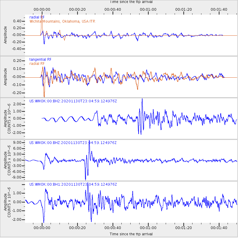
WMOK Wichita Mountains, Oklahoma, USA - Earthquake Result Viewer
*The percent match for this event was below the threshold and hence no stack was calculated.
| Earthquake location: |
Chile-Argentina Border Region |
| Earthquake latitude/longitude: |
-24.4/-67.1 |
| Earthquake time(UTC): |
2020/11/30 (335) 22:54:59 GMT |
| Earthquake Depth: |
148 km |
| Earthquake Magnitude: |
6.3 mww |
| Earthquake Catalog/Contributor: |
NEIC PDE/us |
|
| Network: |
US United States National Seismic Network |
| Station: |
WMOK Wichita Mountains, Oklahoma, USA |
| Lat/Lon: |
34.74 N/98.78 W |
| Elevation: |
486 m |
|
| Distance: |
66.1 deg |
| Az: |
331.713 deg |
| Baz: |
148.351 deg |
| Ray Param: |
$rayparam |
*The percent match for this event was below the threshold and hence was not used in the summary stack. |
|
| Radial Match: |
57.355225 % |
| Radial Bump: |
400 |
| Transverse Match: |
69.32593 % |
| Transverse Bump: |
400 |
| SOD ConfigId: |
23341671 |
| Insert Time: |
2020-12-15 01:00:56.126 +0000 |
| GWidth: |
2.5 |
| Max Bumps: |
400 |
| Tol: |
0.001 |
|
Signal To Noise
| Channel | StoN | STA | LTA |
| US:WMOK:00:BHZ:20201130T23:04:59.124976Z | 4.580939 | 2.2376673E-6 | 4.884735E-7 |
| US:WMOK:00:BH1:20201130T23:04:59.124976Z | 3.3491812 | 9.824516E-7 | 2.9334086E-7 |
| US:WMOK:00:BH2:20201130T23:04:59.124976Z | 2.958101 | 6.5095526E-7 | 2.2005851E-7 |
| Arrivals |
| Ps | |
| PpPs | |
| PsPs/PpSs | |


