You are here: Home > Network List > US - United States National Seismic Network Stations List
> Station AGMN Agassiz National Wildlife Refuge, Minnesota, USA > Earthquake Result Viewer
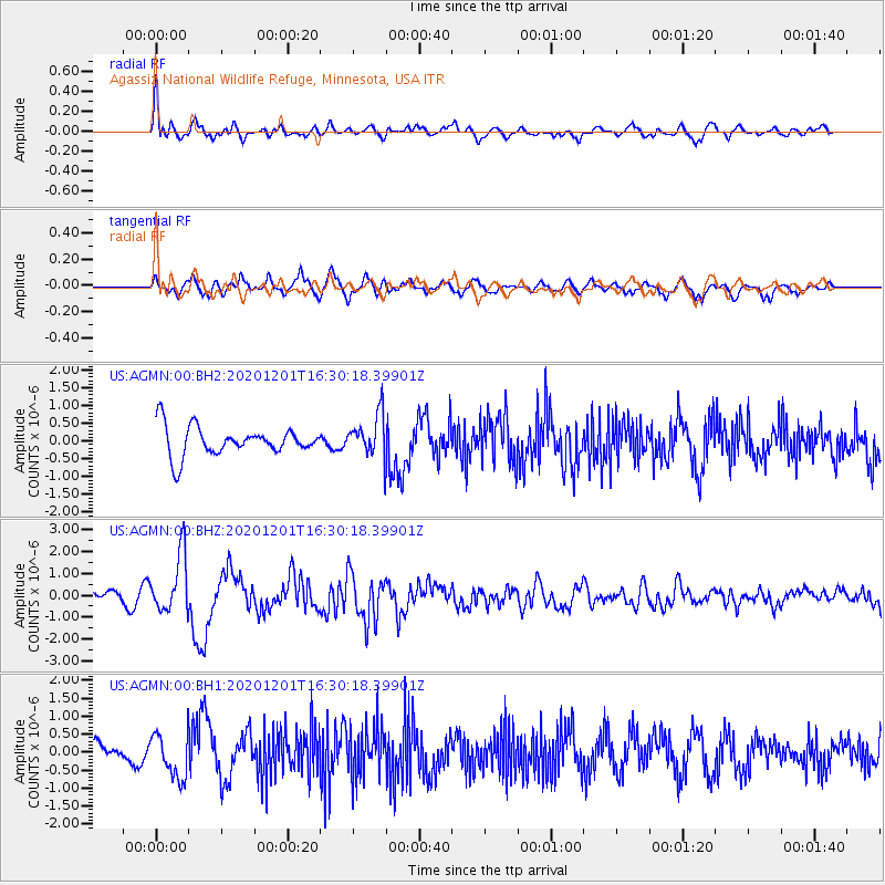
AGMN Agassiz National Wildlife Refuge, Minnesota, USA - Earthquake Result Viewer
*The percent match for this event was below the threshold and hence no stack was calculated.
| Earthquake location: |
Fox Islands, Aleutian Islands |
| Earthquake latitude/longitude: |
52.8/-168.3 |
| Earthquake time(UTC): |
2020/12/01 (336) 16:22:40 GMT |
| Earthquake Depth: |
23 km |
| Earthquake Magnitude: |
6.3 mww |
| Earthquake Catalog/Contributor: |
NEIC PDE/us |
|
| Network: |
US United States National Seismic Network |
| Station: |
AGMN Agassiz National Wildlife Refuge, Minnesota, USA |
| Lat/Lon: |
48.30 N/95.86 W |
| Elevation: |
351 m |
|
| Distance: |
44.4 deg |
| Az: |
65.399 deg |
| Baz: |
304.306 deg |
| Ray Param: |
$rayparam |
*The percent match for this event was below the threshold and hence was not used in the summary stack. |
|
| Radial Match: |
72.72145 % |
| Radial Bump: |
400 |
| Transverse Match: |
61.702633 % |
| Transverse Bump: |
400 |
| SOD ConfigId: |
23341671 |
| Insert Time: |
2020-12-15 17:43:07.991 +0000 |
| GWidth: |
2.5 |
| Max Bumps: |
400 |
| Tol: |
0.001 |
|
Signal To Noise
| Channel | StoN | STA | LTA |
| US:AGMN:00:BHZ:20201201T16:30:18.39901Z | 2.443674 | 1.3487545E-6 | 5.5193715E-7 |
| US:AGMN:00:BH1:20201201T16:30:18.39901Z | 2.2071326 | 6.119101E-7 | 2.772421E-7 |
| US:AGMN:00:BH2:20201201T16:30:18.39901Z | 1.4739412 | 6.059414E-7 | 4.111028E-7 |
| Arrivals |
| Ps | |
| PpPs | |
| PsPs/PpSs | |


