You are here: Home > Network List > US - United States National Seismic Network Stations List
> Station HAWA Hanford, Washington, USA > Earthquake Result Viewer
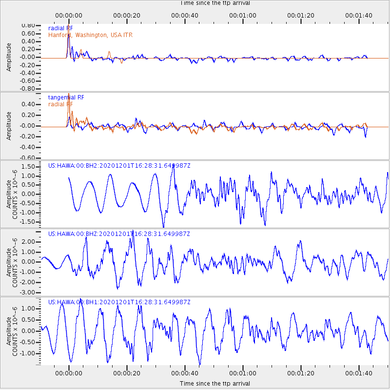
HAWA Hanford, Washington, USA - Earthquake Result Viewer
*The percent match for this event was below the threshold and hence no stack was calculated.
| Earthquake location: |
Fox Islands, Aleutian Islands |
| Earthquake latitude/longitude: |
52.8/-168.3 |
| Earthquake time(UTC): |
2020/12/01 (336) 16:22:40 GMT |
| Earthquake Depth: |
23 km |
| Earthquake Magnitude: |
6.3 mww |
| Earthquake Catalog/Contributor: |
NEIC PDE/us |
|
| Network: |
US United States National Seismic Network |
| Station: |
HAWA Hanford, Washington, USA |
| Lat/Lon: |
46.39 N/119.53 W |
| Elevation: |
364 m |
|
| Distance: |
31.7 deg |
| Az: |
81.773 deg |
| Baz: |
299.833 deg |
| Ray Param: |
$rayparam |
*The percent match for this event was below the threshold and hence was not used in the summary stack. |
|
| Radial Match: |
43.221455 % |
| Radial Bump: |
400 |
| Transverse Match: |
45.205708 % |
| Transverse Bump: |
340 |
| SOD ConfigId: |
23341671 |
| Insert Time: |
2020-12-15 17:43:25.063 +0000 |
| GWidth: |
2.5 |
| Max Bumps: |
400 |
| Tol: |
0.001 |
|
Signal To Noise
| Channel | StoN | STA | LTA |
| US:HAWA:00:BHZ:20201201T16:28:31.649987Z | 1.6191919 | 6.885687E-7 | 4.2525457E-7 |
| US:HAWA:00:BH1:20201201T16:28:31.649987Z | 3.6020863 | 9.4763544E-7 | 2.630796E-7 |
| US:HAWA:00:BH2:20201201T16:28:31.649987Z | 1.7161794 | 1.0024792E-6 | 5.841342E-7 |
| Arrivals |
| Ps | |
| PpPs | |
| PsPs/PpSs | |


