You are here: Home > Network List > IU - Global Seismograph Network (GSN - IRIS/USGS) Stations List
> Station XMAS Kiritimati Island, Republic of Kiribati > Earthquake Result Viewer
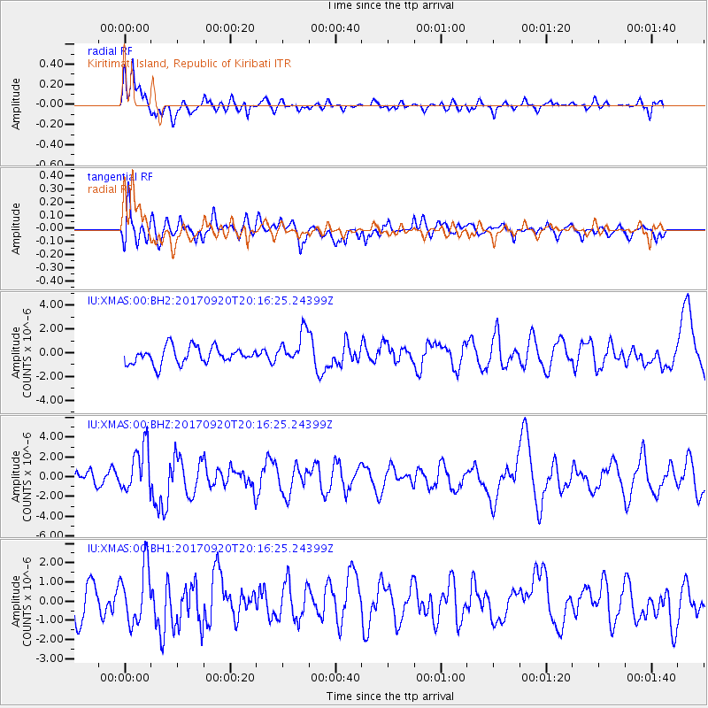
XMAS Kiritimati Island, Republic of Kiribati - Earthquake Result Viewer
*The percent match for this event was below the threshold and hence no stack was calculated.
| Earthquake location: |
Vanuatu Islands |
| Earthquake latitude/longitude: |
-18.8/169.1 |
| Earthquake time(UTC): |
2017/09/20 (263) 20:09:49 GMT |
| Earthquake Depth: |
200 km |
| Earthquake Magnitude: |
6.4 mww |
| Earthquake Catalog/Contributor: |
NEIC PDE/us |
|
| Network: |
IU Global Seismograph Network (GSN - IRIS/USGS) |
| Station: |
XMAS Kiritimati Island, Republic of Kiribati |
| Lat/Lon: |
2.04 N/157.45 W |
| Elevation: |
20 m |
|
| Distance: |
38.9 deg |
| Az: |
61.384 deg |
| Baz: |
236.317 deg |
| Ray Param: |
$rayparam |
*The percent match for this event was below the threshold and hence was not used in the summary stack. |
|
| Radial Match: |
71.07808 % |
| Radial Bump: |
400 |
| Transverse Match: |
57.528522 % |
| Transverse Bump: |
400 |
| SOD ConfigId: |
2341311 |
| Insert Time: |
2017-10-04 21:01:30.428 +0000 |
| GWidth: |
2.5 |
| Max Bumps: |
400 |
| Tol: |
0.001 |
|
Signal To Noise
| Channel | StoN | STA | LTA |
| IU:XMAS:00:BHZ:20170920T20:16:25.24399Z | 3.0424583 | 2.3359285E-6 | 7.6777667E-7 |
| IU:XMAS:00:BH1:20170920T20:16:25.24399Z | 1.6908761 | 1.4568477E-6 | 8.6159343E-7 |
| IU:XMAS:00:BH2:20170920T20:16:25.24399Z | 1.9780781 | 1.392024E-6 | 7.037255E-7 |
| Arrivals |
| Ps | |
| PpPs | |
| PsPs/PpSs | |


