You are here: Home > Network List > US - United States National Seismic Network Stations List
> Station WMOK Wichita Mountains, Oklahoma, USA > Earthquake Result Viewer
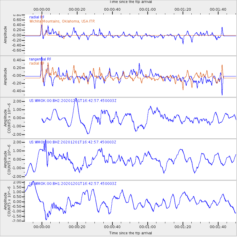
WMOK Wichita Mountains, Oklahoma, USA - Earthquake Result Viewer
*The percent match for this event was below the threshold and hence no stack was calculated.
| Earthquake location: |
South Of Alaska |
| Earthquake latitude/longitude: |
53.7/-150.6 |
| Earthquake time(UTC): |
2020/12/01 (336) 16:35:48 GMT |
| Earthquake Depth: |
10 km |
| Earthquake Magnitude: |
5.7 Mww |
| Earthquake Catalog/Contributor: |
NEIC PDE/us |
|
| Network: |
US United States National Seismic Network |
| Station: |
WMOK Wichita Mountains, Oklahoma, USA |
| Lat/Lon: |
34.74 N/98.78 W |
| Elevation: |
486 m |
|
| Distance: |
40.6 deg |
| Az: |
96.357 deg |
| Baz: |
314.141 deg |
| Ray Param: |
$rayparam |
*The percent match for this event was below the threshold and hence was not used in the summary stack. |
|
| Radial Match: |
59.104088 % |
| Radial Bump: |
400 |
| Transverse Match: |
59.443703 % |
| Transverse Bump: |
400 |
| SOD ConfigId: |
23341671 |
| Insert Time: |
2020-12-15 18:00:08.032 +0000 |
| GWidth: |
2.5 |
| Max Bumps: |
400 |
| Tol: |
0.001 |
|
Signal To Noise
| Channel | StoN | STA | LTA |
| US:WMOK:00:BHZ:20201201T16:42:57.450003Z | 2.06474 | 1.3158234E-6 | 6.372829E-7 |
| US:WMOK:00:BH1:20201201T16:42:57.450003Z | 1.1972064 | 1.1605831E-6 | 9.694095E-7 |
| US:WMOK:00:BH2:20201201T16:42:57.450003Z | 0.53250283 | 4.4568216E-7 | 8.369573E-7 |
| Arrivals |
| Ps | |
| PpPs | |
| PsPs/PpSs | |


