You are here: Home > Network List > IU - Global Seismograph Network (GSN - IRIS/USGS) Stations List
> Station PMG Port Moresby, New Guinea > Earthquake Result Viewer
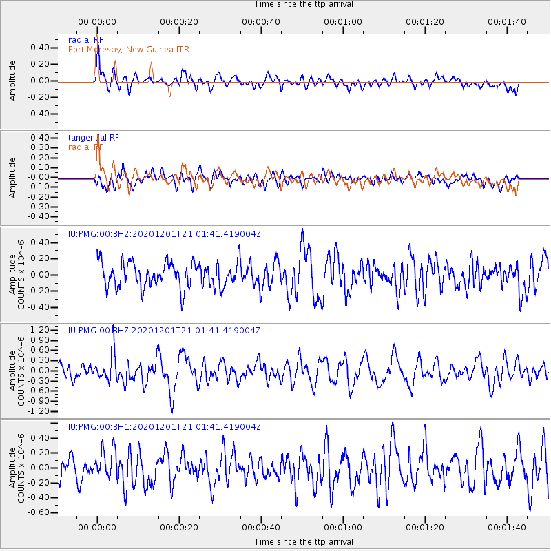
PMG Port Moresby, New Guinea - Earthquake Result Viewer
*The percent match for this event was below the threshold and hence no stack was calculated.
| Earthquake location: |
Balleny Islands Region |
| Earthquake latitude/longitude: |
-62.0/154.7 |
| Earthquake time(UTC): |
2020/12/01 (336) 20:52:57 GMT |
| Earthquake Depth: |
10 km |
| Earthquake Magnitude: |
6.2 Mww |
| Earthquake Catalog/Contributor: |
NEIC PDE/us |
|
| Network: |
IU Global Seismograph Network (GSN - IRIS/USGS) |
| Station: |
PMG Port Moresby, New Guinea |
| Lat/Lon: |
9.40 S/147.16 E |
| Elevation: |
90 m |
|
| Distance: |
52.8 deg |
| Az: |
350.637 deg |
| Baz: |
175.534 deg |
| Ray Param: |
$rayparam |
*The percent match for this event was below the threshold and hence was not used in the summary stack. |
|
| Radial Match: |
66.947784 % |
| Radial Bump: |
400 |
| Transverse Match: |
57.69008 % |
| Transverse Bump: |
400 |
| SOD ConfigId: |
23341671 |
| Insert Time: |
2020-12-15 21:57:15.194 +0000 |
| GWidth: |
2.5 |
| Max Bumps: |
400 |
| Tol: |
0.001 |
|
Signal To Noise
| Channel | StoN | STA | LTA |
| IU:PMG:00:BHZ:20201201T21:01:41.419004Z | 2.793689 | 4.4719036E-7 | 1.6007162E-7 |
| IU:PMG:00:BH1:20201201T21:01:41.419004Z | 1.3757409 | 1.9679257E-7 | 1.4304479E-7 |
| IU:PMG:00:BH2:20201201T21:01:41.419004Z | 1.0344 | 1.582596E-7 | 1.5299653E-7 |
| Arrivals |
| Ps | |
| PpPs | |
| PsPs/PpSs | |


