You are here: Home > Network List > US - United States National Seismic Network Stations List
> Station HAWA Hanford, Washington, USA > Earthquake Result Viewer
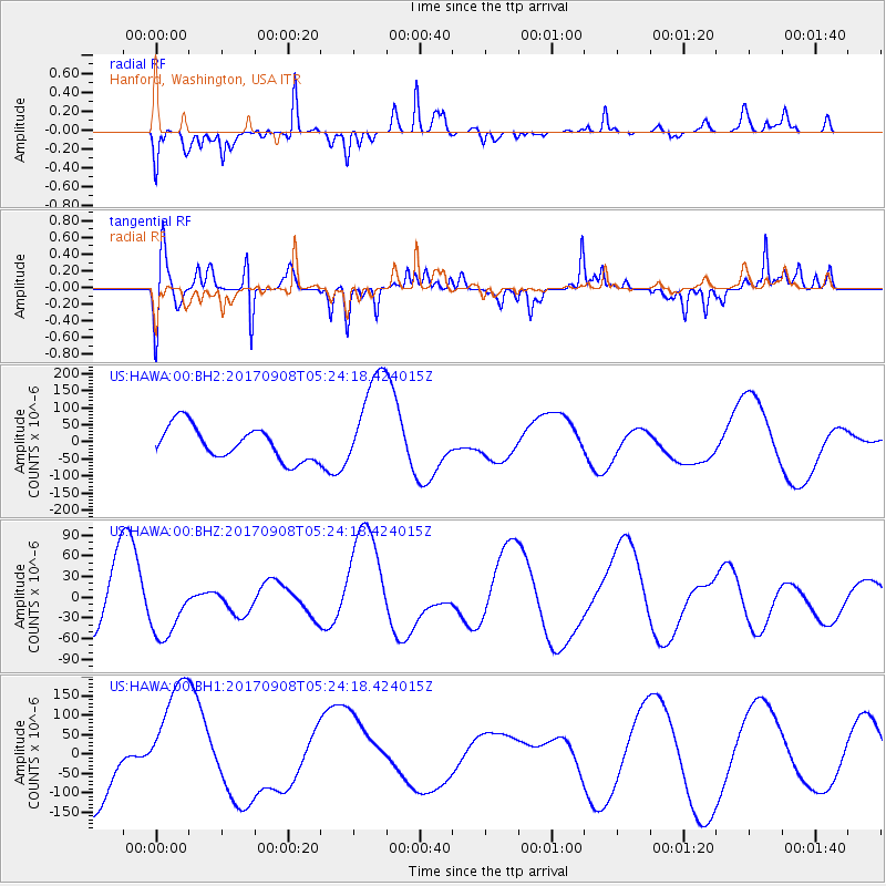
HAWA Hanford, Washington, USA - Earthquake Result Viewer
*The percent match for this event was below the threshold and hence no stack was calculated.
| Earthquake location: |
Near Coast Of Oaxaca, Mexico |
| Earthquake latitude/longitude: |
15.6/-94.6 |
| Earthquake time(UTC): |
2017/09/08 (251) 05:17:43 GMT |
| Earthquake Depth: |
51 km |
| Earthquake Magnitude: |
5.3 mb |
| Earthquake Catalog/Contributor: |
NEIC PDE/us |
|
| Network: |
US United States National Seismic Network |
| Station: |
HAWA Hanford, Washington, USA |
| Lat/Lon: |
46.39 N/119.53 W |
| Elevation: |
364 m |
|
| Distance: |
37.1 deg |
| Az: |
331.054 deg |
| Baz: |
137.631 deg |
| Ray Param: |
$rayparam |
*The percent match for this event was below the threshold and hence was not used in the summary stack. |
|
| Radial Match: |
52.649982 % |
| Radial Bump: |
354 |
| Transverse Match: |
39.4545 % |
| Transverse Bump: |
290 |
| SOD ConfigId: |
2341311 |
| Insert Time: |
2017-10-05 06:46:44.265 +0000 |
| GWidth: |
2.5 |
| Max Bumps: |
400 |
| Tol: |
0.001 |
|
Signal To Noise
| Channel | StoN | STA | LTA |
| US:HAWA:00:BHZ:20170908T05:24:18.424015Z | 1.2739071 | 4.3230677E-5 | 3.3935503E-5 |
| US:HAWA:00:BH1:20170908T05:24:18.424015Z | 1.9557828 | 1.4615705E-4 | 7.473071E-5 |
| US:HAWA:00:BH2:20170908T05:24:18.424015Z | 3.0626805 | 1.498211E-4 | 4.8918297E-5 |
| Arrivals |
| Ps | |
| PpPs | |
| PsPs/PpSs | |


