You are here: Home > Network List > US - United States National Seismic Network Stations List
> Station CBKS Cedar Bluff, Kansas, USA > Earthquake Result Viewer
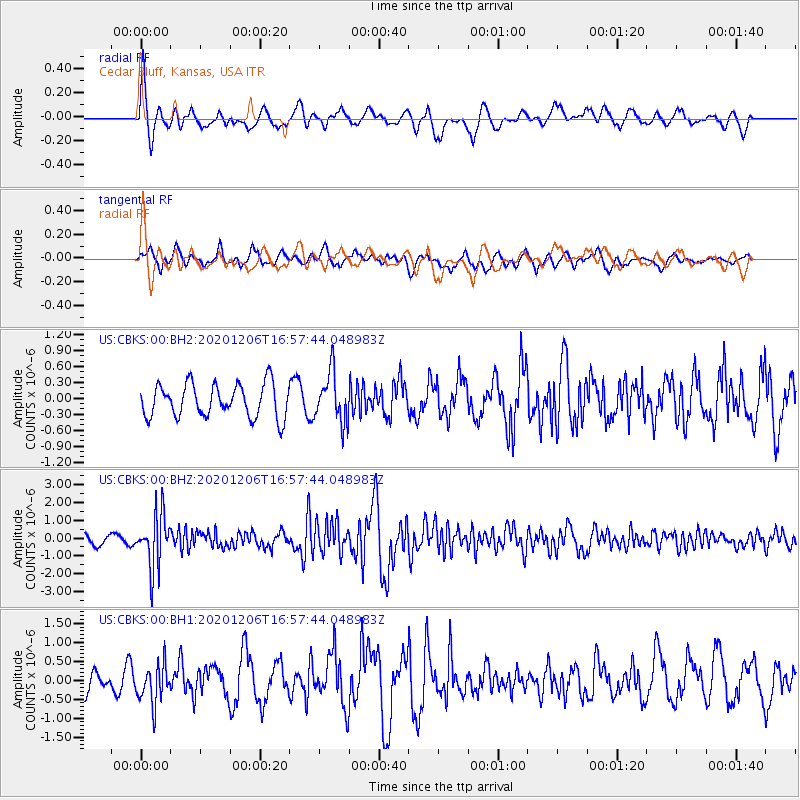
CBKS Cedar Bluff, Kansas, USA - Earthquake Result Viewer
*The percent match for this event was below the threshold and hence no stack was calculated.
| Earthquake location: |
Northern Chile |
| Earthquake latitude/longitude: |
-20.4/-69.1 |
| Earthquake time(UTC): |
2020/12/06 (341) 16:47:41 GMT |
| Earthquake Depth: |
98 km |
| Earthquake Magnitude: |
6.1 mww |
| Earthquake Catalog/Contributor: |
NEIC PDE/us |
|
| Network: |
US United States National Seismic Network |
| Station: |
CBKS Cedar Bluff, Kansas, USA |
| Lat/Lon: |
38.81 N/99.74 W |
| Elevation: |
677 m |
|
| Distance: |
65.5 deg |
| Az: |
334.059 deg |
| Baz: |
148.311 deg |
| Ray Param: |
$rayparam |
*The percent match for this event was below the threshold and hence was not used in the summary stack. |
|
| Radial Match: |
56.924156 % |
| Radial Bump: |
400 |
| Transverse Match: |
63.0921 % |
| Transverse Bump: |
400 |
| SOD ConfigId: |
23341671 |
| Insert Time: |
2020-12-20 18:12:22.560 +0000 |
| GWidth: |
2.5 |
| Max Bumps: |
400 |
| Tol: |
0.001 |
|
Signal To Noise
| Channel | StoN | STA | LTA |
| US:CBKS:00:BHZ:20201206T16:57:44.048983Z | 8.751543 | 1.5200277E-6 | 1.7368681E-7 |
| US:CBKS:00:BH1:20201206T16:57:44.048983Z | 0.9296498 | 5.113318E-7 | 5.500263E-7 |
| US:CBKS:00:BH2:20201206T16:57:44.048983Z | 1.498822 | 4.6510806E-7 | 3.1031573E-7 |
| Arrivals |
| Ps | |
| PpPs | |
| PsPs/PpSs | |


