You are here: Home > Network List > US - United States National Seismic Network Stations List
> Station LAO LASA Array, Montana, USA > Earthquake Result Viewer
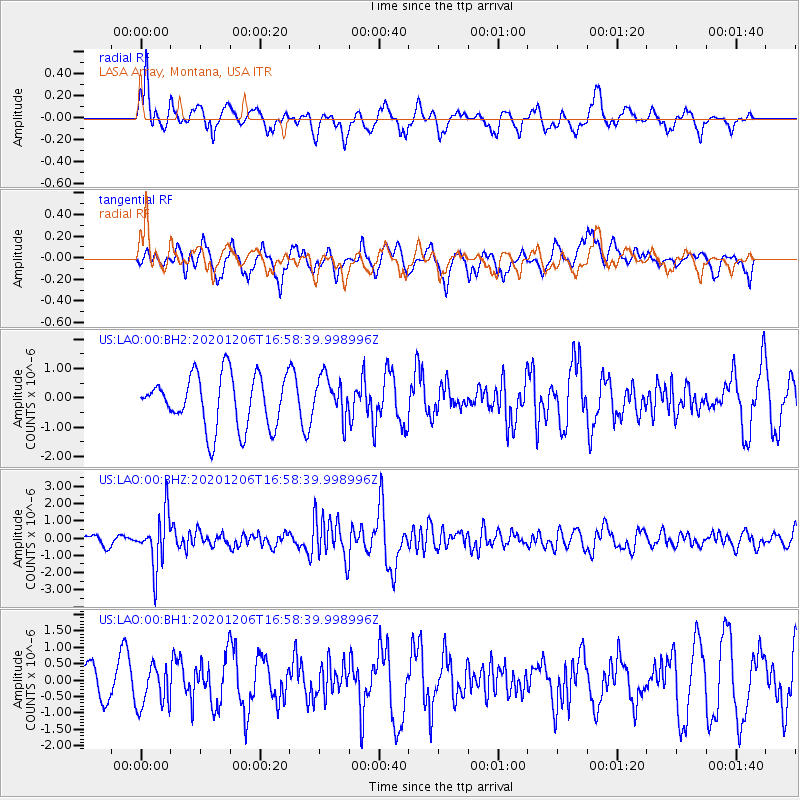
LAO LASA Array, Montana, USA - Earthquake Result Viewer
*The percent match for this event was below the threshold and hence no stack was calculated.
| Earthquake location: |
Northern Chile |
| Earthquake latitude/longitude: |
-20.4/-69.1 |
| Earthquake time(UTC): |
2020/12/06 (341) 16:47:41 GMT |
| Earthquake Depth: |
98 km |
| Earthquake Magnitude: |
6.1 mww |
| Earthquake Catalog/Contributor: |
NEIC PDE/us |
|
| Network: |
US United States National Seismic Network |
| Station: |
LAO LASA Array, Montana, USA |
| Lat/Lon: |
46.69 N/106.22 W |
| Elevation: |
902 m |
|
| Distance: |
74.7 deg |
| Az: |
334.487 deg |
| Baz: |
144.058 deg |
| Ray Param: |
$rayparam |
*The percent match for this event was below the threshold and hence was not used in the summary stack. |
|
| Radial Match: |
63.721092 % |
| Radial Bump: |
399 |
| Transverse Match: |
55.275352 % |
| Transverse Bump: |
398 |
| SOD ConfigId: |
23341671 |
| Insert Time: |
2020-12-20 18:12:50.530 +0000 |
| GWidth: |
2.5 |
| Max Bumps: |
400 |
| Tol: |
0.001 |
|
Signal To Noise
| Channel | StoN | STA | LTA |
| US:LAO:00:BHZ:20201206T16:58:39.998996Z | 5.3654513 | 1.5333778E-6 | 2.8578728E-7 |
| US:LAO:00:BH1:20201206T16:58:39.998996Z | 1.0490665 | 6.40093E-7 | 6.101548E-7 |
| US:LAO:00:BH2:20201206T16:58:39.998996Z | 0.7932999 | 7.0628806E-7 | 8.903165E-7 |
| Arrivals |
| Ps | |
| PpPs | |
| PsPs/PpSs | |


