You are here: Home > Network List > IU - Global Seismograph Network (GSN - IRIS/USGS) Stations List
> Station POHA Pohakuloa, Hawaii, USA > Earthquake Result Viewer
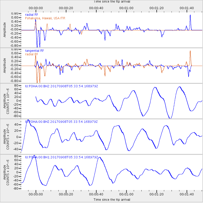
POHA Pohakuloa, Hawaii, USA - Earthquake Result Viewer
*The percent match for this event was below the threshold and hence no stack was calculated.
| Earthquake location: |
Near Coast Of Oaxaca, Mexico |
| Earthquake latitude/longitude: |
15.2/-94.6 |
| Earthquake time(UTC): |
2017/09/08 (251) 05:24:36 GMT |
| Earthquake Depth: |
49 km |
| Earthquake Magnitude: |
5.2 mb |
| Earthquake Catalog/Contributor: |
NEIC PDE/us |
|
| Network: |
IU Global Seismograph Network (GSN - IRIS/USGS) |
| Station: |
POHA Pohakuloa, Hawaii, USA |
| Lat/Lon: |
19.76 N/155.53 W |
| Elevation: |
1990 m |
|
| Distance: |
58.0 deg |
| Az: |
283.995 deg |
| Baz: |
84.056 deg |
| Ray Param: |
$rayparam |
*The percent match for this event was below the threshold and hence was not used in the summary stack. |
|
| Radial Match: |
73.853485 % |
| Radial Bump: |
376 |
| Transverse Match: |
50.50484 % |
| Transverse Bump: |
400 |
| SOD ConfigId: |
2341311 |
| Insert Time: |
2017-10-05 06:50:05.893 +0000 |
| GWidth: |
2.5 |
| Max Bumps: |
400 |
| Tol: |
0.001 |
|
Signal To Noise
| Channel | StoN | STA | LTA |
| IU:POHA:00:BHZ:20170908T05:33:54.168979Z | 0.69683444 | 2.2369019E-5 | 3.2100907E-5 |
| IU:POHA:00:BH1:20170908T05:33:54.168979Z | 1.8162003 | 5.154342E-5 | 2.8379809E-5 |
| IU:POHA:00:BH2:20170908T05:33:54.168979Z | 0.6618534 | 8.023812E-6 | 1.2123248E-5 |
| Arrivals |
| Ps | |
| PpPs | |
| PsPs/PpSs | |


