You are here: Home > Network List > CU - Caribbean Network (USGS) Stations List
> Station BBGH Gun Hill, Barbados > Earthquake Result Viewer
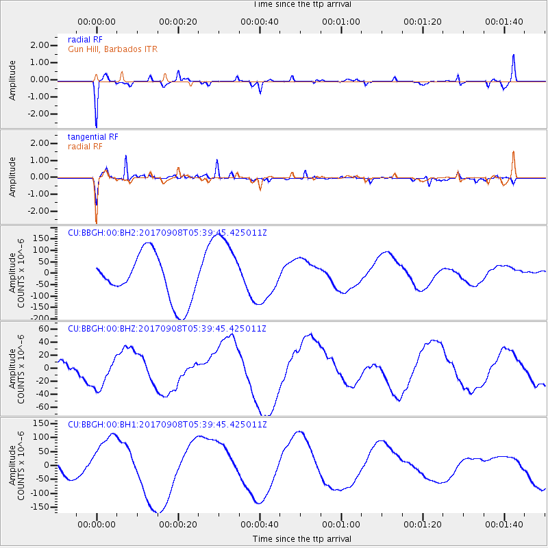
BBGH Gun Hill, Barbados - Earthquake Result Viewer
*The percent match for this event was below the threshold and hence no stack was calculated.
| Earthquake location: |
Near Coast Of Oaxaca, Mexico |
| Earthquake latitude/longitude: |
15.3/-94.4 |
| Earthquake time(UTC): |
2017/09/08 (251) 05:33:37 GMT |
| Earthquake Depth: |
46 km |
| Earthquake Magnitude: |
5.2 mb |
| Earthquake Catalog/Contributor: |
NEIC PDE/us |
|
| Network: |
CU Caribbean Network (USGS) |
| Station: |
BBGH Gun Hill, Barbados |
| Lat/Lon: |
13.14 N/59.56 W |
| Elevation: |
180 m |
|
| Distance: |
33.8 deg |
| Az: |
89.112 deg |
| Baz: |
277.872 deg |
| Ray Param: |
$rayparam |
*The percent match for this event was below the threshold and hence was not used in the summary stack. |
|
| Radial Match: |
45.501488 % |
| Radial Bump: |
322 |
| Transverse Match: |
74.20561 % |
| Transverse Bump: |
371 |
| SOD ConfigId: |
2341311 |
| Insert Time: |
2017-10-05 06:52:52.170 +0000 |
| GWidth: |
2.5 |
| Max Bumps: |
400 |
| Tol: |
0.001 |
|
Signal To Noise
| Channel | StoN | STA | LTA |
| CU:BBGH:00:BHZ:20170908T05:39:45.425011Z | 1.9955815 | 2.4054894E-5 | 1.2054077E-5 |
| CU:BBGH:00:BH1:20170908T05:39:45.425011Z | 3.3857539 | 9.662865E-5 | 2.8539775E-5 |
| CU:BBGH:00:BH2:20170908T05:39:45.425011Z | 1.6141078 | 1.6039703E-4 | 9.9371944E-5 |
| Arrivals |
| Ps | |
| PpPs | |
| PsPs/PpSs | |


