You are here: Home > Network List > TA - USArray Transportable Network (new EarthScope stations) Stations List
> Station R33M Jennings River, BC, CAN > Earthquake Result Viewer
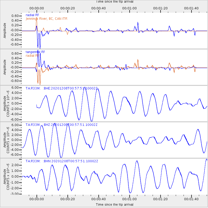
R33M Jennings River, BC, CAN - Earthquake Result Viewer
*The percent match for this event was below the threshold and hence no stack was calculated.
| Earthquake location: |
Volcano Islands, Japan Region |
| Earthquake latitude/longitude: |
22.5/144.8 |
| Earthquake time(UTC): |
2020/12/08 (343) 00:47:22 GMT |
| Earthquake Depth: |
10 km |
| Earthquake Magnitude: |
5.3 mww |
| Earthquake Catalog/Contributor: |
NEIC PDE/us |
|
| Network: |
TA USArray Transportable Network (new EarthScope stations) |
| Station: |
R33M Jennings River, BC, CAN |
| Lat/Lon: |
59.39 N/130.97 W |
| Elevation: |
1437 m |
|
| Distance: |
68.0 deg |
| Az: |
33.301 deg |
| Baz: |
277.167 deg |
| Ray Param: |
$rayparam |
*The percent match for this event was below the threshold and hence was not used in the summary stack. |
|
| Radial Match: |
88.6127 % |
| Radial Bump: |
400 |
| Transverse Match: |
90.37015 % |
| Transverse Bump: |
349 |
| SOD ConfigId: |
23341671 |
| Insert Time: |
2020-12-22 02:00:23.353 +0000 |
| GWidth: |
2.5 |
| Max Bumps: |
400 |
| Tol: |
0.001 |
|
Signal To Noise
| Channel | StoN | STA | LTA |
| TA:R33M: :BHZ:20201208T00:57:51.10002Z | 2.1630094 | 4.5648862E-6 | 2.110433E-6 |
| TA:R33M: :BHN:20201208T00:57:51.10002Z | 0.7992198 | 8.916247E-7 | 1.1156189E-6 |
| TA:R33M: :BHE:20201208T00:57:51.10002Z | 1.4834704 | 3.937606E-6 | 2.6543205E-6 |
| Arrivals |
| Ps | |
| PpPs | |
| PsPs/PpSs | |


