You are here: Home > Network List > US - United States National Seismic Network Stations List
> Station HAWA Hanford, Washington, USA > Earthquake Result Viewer
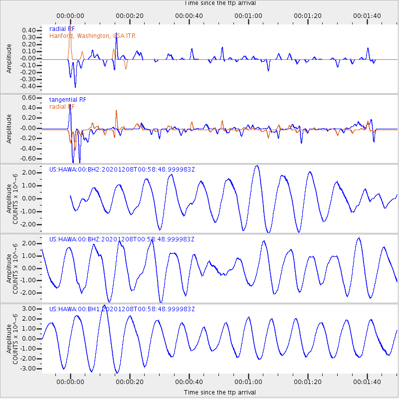
HAWA Hanford, Washington, USA - Earthquake Result Viewer
*The percent match for this event was below the threshold and hence no stack was calculated.
| Earthquake location: |
Volcano Islands, Japan Region |
| Earthquake latitude/longitude: |
22.5/144.8 |
| Earthquake time(UTC): |
2020/12/08 (343) 00:47:22 GMT |
| Earthquake Depth: |
10 km |
| Earthquake Magnitude: |
5.3 mww |
| Earthquake Catalog/Contributor: |
NEIC PDE/us |
|
| Network: |
US United States National Seismic Network |
| Station: |
HAWA Hanford, Washington, USA |
| Lat/Lon: |
46.39 N/119.53 W |
| Elevation: |
364 m |
|
| Distance: |
77.8 deg |
| Az: |
44.796 deg |
| Baz: |
289.735 deg |
| Ray Param: |
$rayparam |
*The percent match for this event was below the threshold and hence was not used in the summary stack. |
|
| Radial Match: |
77.59252 % |
| Radial Bump: |
231 |
| Transverse Match: |
61.44145 % |
| Transverse Bump: |
400 |
| SOD ConfigId: |
23341671 |
| Insert Time: |
2020-12-22 02:01:29.070 +0000 |
| GWidth: |
2.5 |
| Max Bumps: |
400 |
| Tol: |
0.001 |
|
Signal To Noise
| Channel | StoN | STA | LTA |
| US:HAWA:00:BHZ:20201208T00:58:48.999983Z | 0.7274596 | 1.4163844E-6 | 1.947028E-6 |
| US:HAWA:00:BH1:20201208T00:58:48.999983Z | 1.5864406 | 1.5756716E-6 | 9.932118E-7 |
| US:HAWA:00:BH2:20201208T00:58:48.999983Z | 2.4481542 | 1.6550501E-6 | 6.7604E-7 |
| Arrivals |
| Ps | |
| PpPs | |
| PsPs/PpSs | |


