You are here: Home > Network List > G - GEOSCOPE Stations List
> Station MPG Montagne des Peres, French Guyana > Earthquake Result Viewer
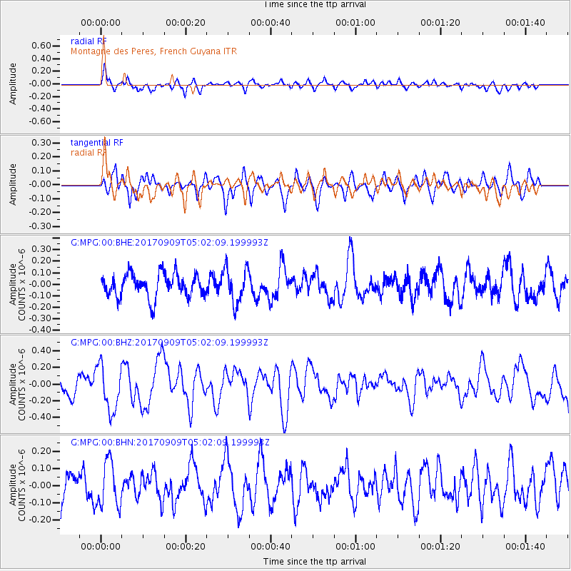
MPG Montagne des Peres, French Guyana - Earthquake Result Viewer
*The percent match for this event was below the threshold and hence no stack was calculated.
| Earthquake location: |
Near Coast Of Chiapas, Mexico |
| Earthquake latitude/longitude: |
15.1/-93.9 |
| Earthquake time(UTC): |
2017/09/09 (252) 04:54:52 GMT |
| Earthquake Depth: |
29 km |
| Earthquake Magnitude: |
5.5 Mww |
| Earthquake Catalog/Contributor: |
NEIC PDE/us |
|
| Network: |
G GEOSCOPE |
| Station: |
MPG Montagne des Peres, French Guyana |
| Lat/Lon: |
5.11 N/52.64 W |
| Elevation: |
147 m |
|
| Distance: |
41.8 deg |
| Az: |
99.342 deg |
| Baz: |
286.883 deg |
| Ray Param: |
$rayparam |
*The percent match for this event was below the threshold and hence was not used in the summary stack. |
|
| Radial Match: |
62.45476 % |
| Radial Bump: |
400 |
| Transverse Match: |
67.85974 % |
| Transverse Bump: |
400 |
| SOD ConfigId: |
2341311 |
| Insert Time: |
2017-10-05 06:56:04.125 +0000 |
| GWidth: |
2.5 |
| Max Bumps: |
400 |
| Tol: |
0.001 |
|
Signal To Noise
| Channel | StoN | STA | LTA |
| G:MPG:00:BHZ:20170909T05:02:09.199993Z | 1.7794547 | 2.7963702E-7 | 1.571476E-7 |
| G:MPG:00:BHN:20170909T05:02:09.199993Z | 1.243417 | 1.3131186E-7 | 1.0560565E-7 |
| G:MPG:00:BHE:20170909T05:02:09.199993Z | 1.4324532 | 1.4609255E-7 | 1.0198766E-7 |
| Arrivals |
| Ps | |
| PpPs | |
| PsPs/PpSs | |


