You are here: Home > Network List > CU - Caribbean Network (USGS) Stations List
> Station BBGH Gun Hill, Barbados > Earthquake Result Viewer
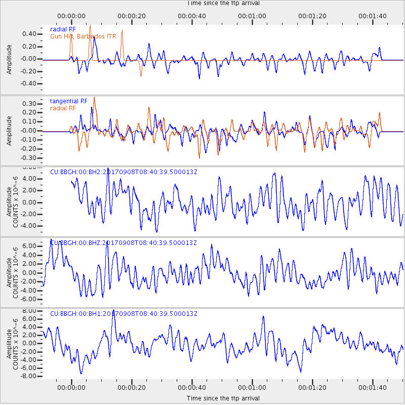
BBGH Gun Hill, Barbados - Earthquake Result Viewer
*The percent match for this event was below the threshold and hence no stack was calculated.
| Earthquake location: |
Near Coast Of Oaxaca, Mexico |
| Earthquake latitude/longitude: |
15.2/-94.2 |
| Earthquake time(UTC): |
2017/09/08 (251) 08:34:34 GMT |
| Earthquake Depth: |
51 km |
| Earthquake Magnitude: |
5.3 mb |
| Earthquake Catalog/Contributor: |
NEIC PDE/us |
|
| Network: |
CU Caribbean Network (USGS) |
| Station: |
BBGH Gun Hill, Barbados |
| Lat/Lon: |
13.14 N/59.56 W |
| Elevation: |
180 m |
|
| Distance: |
33.6 deg |
| Az: |
89.064 deg |
| Baz: |
277.741 deg |
| Ray Param: |
$rayparam |
*The percent match for this event was below the threshold and hence was not used in the summary stack. |
|
| Radial Match: |
60.21139 % |
| Radial Bump: |
400 |
| Transverse Match: |
68.03689 % |
| Transverse Bump: |
394 |
| SOD ConfigId: |
2341311 |
| Insert Time: |
2017-10-06 09:24:39.522 +0000 |
| GWidth: |
2.5 |
| Max Bumps: |
400 |
| Tol: |
0.001 |
|
Signal To Noise
| Channel | StoN | STA | LTA |
| CU:BBGH:00:BHZ:20170908T08:40:39.500013Z | 0.6620723 | 2.473749E-6 | 3.7363727E-6 |
| CU:BBGH:00:BH1:20170908T08:40:39.500013Z | 2.2914917 | 5.0104913E-6 | 2.1865633E-6 |
| CU:BBGH:00:BH2:20170908T08:40:39.500013Z | 0.6781075 | 1.4474389E-6 | 2.1345272E-6 |
| Arrivals |
| Ps | |
| PpPs | |
| PsPs/PpSs | |


