You are here: Home > Network List > AV - Alaska Volcano Observatory Stations List
> Station MAPS Pakushin Southeast, Makushin Volcano, Alaska > Earthquake Result Viewer
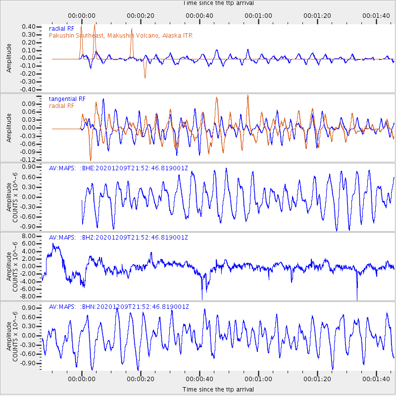
MAPS Pakushin Southeast, Makushin Volcano, Alaska - Earthquake Result Viewer
*The percent match for this event was below the threshold and hence no stack was calculated.
| Earthquake location: |
Lake Baykal Region, Russia |
| Earthquake latitude/longitude: |
52.4/106.7 |
| Earthquake time(UTC): |
2020/12/09 (344) 21:44:33 GMT |
| Earthquake Depth: |
10 km |
| Earthquake Magnitude: |
5.5 mww |
| Earthquake Catalog/Contributor: |
NEIC PDE/us |
|
| Network: |
AV Alaska Volcano Observatory |
| Station: |
MAPS Pakushin Southeast, Makushin Volcano, Alaska |
| Lat/Lon: |
53.81 N/166.94 W |
| Elevation: |
333 m |
|
| Distance: |
48.7 deg |
| Az: |
51.948 deg |
| Baz: |
305.603 deg |
| Ray Param: |
$rayparam |
*The percent match for this event was below the threshold and hence was not used in the summary stack. |
|
| Radial Match: |
58.129456 % |
| Radial Bump: |
400 |
| Transverse Match: |
52.87667 % |
| Transverse Bump: |
400 |
| SOD ConfigId: |
23341671 |
| Insert Time: |
2020-12-23 22:48:28.183 +0000 |
| GWidth: |
2.5 |
| Max Bumps: |
400 |
| Tol: |
0.001 |
|
Signal To Noise
| Channel | StoN | STA | LTA |
| AV:MAPS: :BHZ:20201209T21:52:46.819001Z | 1.1316726 | 2.7167087E-6 | 2.4006135E-6 |
| AV:MAPS: :BHN:20201209T21:52:46.819001Z | 1.3760165 | 6.0319593E-7 | 4.3836386E-7 |
| AV:MAPS: :BHE:20201209T21:52:46.819001Z | 1.0634679 | 3.5557193E-7 | 3.3435137E-7 |
| Arrivals |
| Ps | |
| PpPs | |
| PsPs/PpSs | |


