You are here: Home > Network List > GS - US Geological Survey Networks Stations List
> Station MT02 Nevada Ogden Rd, Helena Natl Forest, Montana, USA > Earthquake Result Viewer
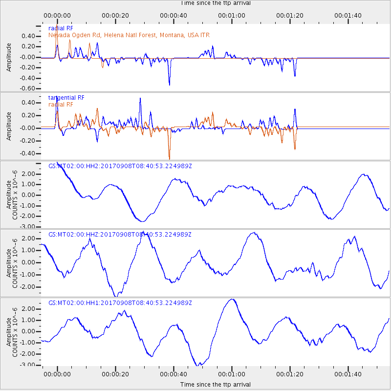
MT02 Nevada Ogden Rd, Helena Natl Forest, Montana, USA - Earthquake Result Viewer
*The percent match for this event was below the threshold and hence no stack was calculated.
| Earthquake location: |
Near Coast Of Oaxaca, Mexico |
| Earthquake latitude/longitude: |
15.2/-94.2 |
| Earthquake time(UTC): |
2017/09/08 (251) 08:34:34 GMT |
| Earthquake Depth: |
51 km |
| Earthquake Magnitude: |
5.3 mb |
| Earthquake Catalog/Contributor: |
NEIC PDE/us |
|
| Network: |
GS US Geological Survey Networks |
| Station: |
MT02 Nevada Ogden Rd, Helena Natl Forest, Montana, USA |
| Lat/Lon: |
46.86 N/112.88 W |
| Elevation: |
1672 m |
|
| Distance: |
35.2 deg |
| Az: |
337.549 deg |
| Baz: |
147.504 deg |
| Ray Param: |
$rayparam |
*The percent match for this event was below the threshold and hence was not used in the summary stack. |
|
| Radial Match: |
67.0418 % |
| Radial Bump: |
284 |
| Transverse Match: |
44.8748 % |
| Transverse Bump: |
400 |
| SOD ConfigId: |
2341311 |
| Insert Time: |
2017-10-06 09:25:30.680 +0000 |
| GWidth: |
2.5 |
| Max Bumps: |
400 |
| Tol: |
0.001 |
|
Signal To Noise
| Channel | StoN | STA | LTA |
| GS:MT02:00:HHZ:20170908T08:40:53.224989Z | 0.62766427 | 6.30808E-7 | 1.0050086E-6 |
| GS:MT02:00:HH1:20170908T08:40:53.224989Z | 1.4535631 | 9.982318E-7 | 6.867482E-7 |
| GS:MT02:00:HH2:20170908T08:40:53.224989Z | 2.750611 | 2.6156954E-6 | 9.5095066E-7 |
| Arrivals |
| Ps | |
| PpPs | |
| PsPs/PpSs | |


