You are here: Home > Network List > AV - Alaska Volcano Observatory Stations List
> Station KAVE Katnai Ventifact, Alaska > Earthquake Result Viewer
KAVE Katnai Ventifact, Alaska - Earthquake Result Viewer
*The percent match for this event was below the threshold and hence no stack was calculated.
| Earthquake location: |
Taiwan Region |
| Earthquake latitude/longitude: |
24.8/122.0 |
| Earthquake time(UTC): |
2020/12/10 (345) 13:19:58 GMT |
| Earthquake Depth: |
73 km |
| Earthquake Magnitude: |
6.1 mww |
| Earthquake Catalog/Contributor: |
NEIC PDE/us |
|
| Network: |
AV Alaska Volcano Observatory |
| Station: |
KAVE Katnai Ventifact, Alaska |
| Lat/Lon: |
58.20 N/155.02 W |
| Elevation: |
702 m |
|
| Distance: |
65.7 deg |
| Az: |
35.231 deg |
| Baz: |
277.96 deg |
| Ray Param: |
$rayparam |
*The percent match for this event was below the threshold and hence was not used in the summary stack. |
|
| Radial Match: |
54.542206 % |
| Radial Bump: |
400 |
| Transverse Match: |
57.6739 % |
| Transverse Bump: |
400 |
| SOD ConfigId: |
23341671 |
| Insert Time: |
2020-12-24 14:26:19.548 +0000 |
| GWidth: |
2.5 |
| Max Bumps: |
400 |
| Tol: |
0.001 |
|
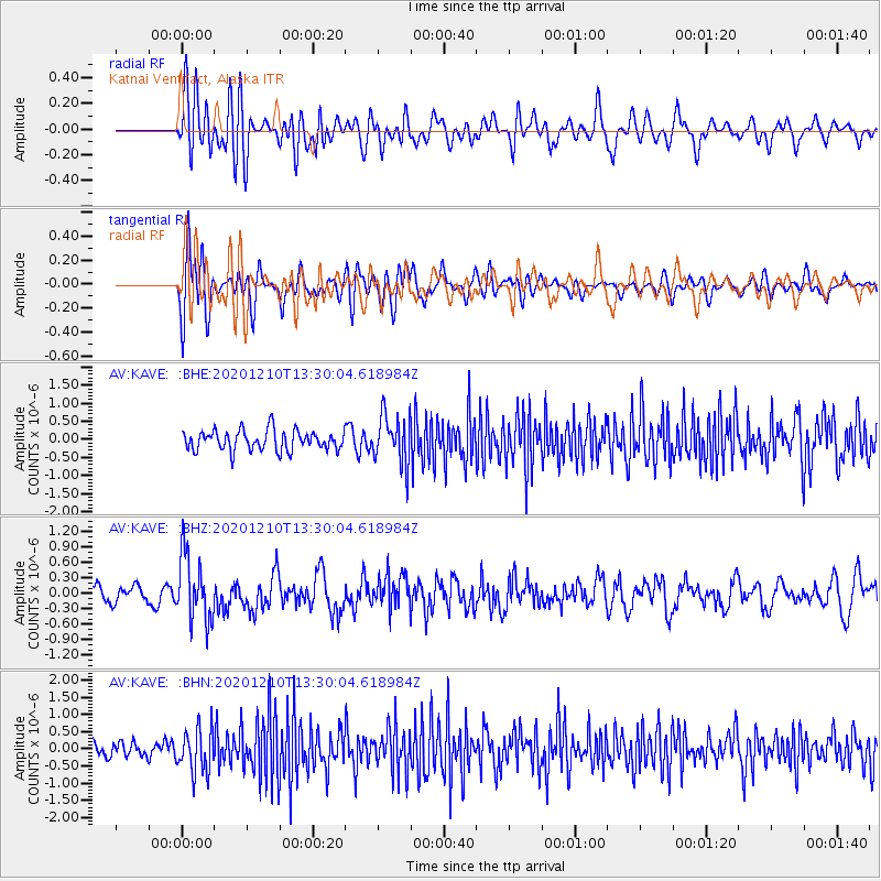
Signal To Noise
| Channel | StoN | STA | LTA |
| AV:KAVE: :BHZ:20201210T13:30:04.618984Z | 3.640407 | 6.400826E-7 | 1.758272E-7 |
| AV:KAVE: :BHN:20201210T13:30:04.618984Z | 2.351369 | 6.373938E-7 | 2.710735E-7 |
| AV:KAVE: :BHE:20201210T13:30:04.618984Z | 2.453086 | 6.841989E-7 | 2.7891355E-7 |
| Arrivals |
| Ps | |
| PpPs | |
| PsPs/PpSs | |


