You are here: Home > Network List > IU - Global Seismograph Network (GSN - IRIS/USGS) Stations List
> Station POHA Pohakuloa, Hawaii, USA > Earthquake Result Viewer
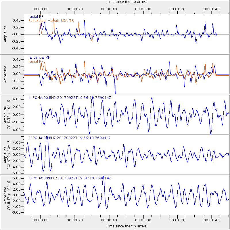
POHA Pohakuloa, Hawaii, USA - Earthquake Result Viewer
*The percent match for this event was below the threshold and hence no stack was calculated.
| Earthquake location: |
Off Coast Of Northern California |
| Earthquake latitude/longitude: |
40.4/-126.8 |
| Earthquake time(UTC): |
2017/09/22 (265) 19:50:15 GMT |
| Earthquake Depth: |
11 km |
| Earthquake Magnitude: |
5.6 Mw |
| Earthquake Catalog/Contributor: |
NEIC PDE/us |
|
| Network: |
IU Global Seismograph Network (GSN - IRIS/USGS) |
| Station: |
POHA Pohakuloa, Hawaii, USA |
| Lat/Lon: |
19.76 N/155.53 W |
| Elevation: |
1990 m |
|
| Distance: |
32.0 deg |
| Az: |
238.519 deg |
| Baz: |
43.736 deg |
| Ray Param: |
$rayparam |
*The percent match for this event was below the threshold and hence was not used in the summary stack. |
|
| Radial Match: |
52.080715 % |
| Radial Bump: |
400 |
| Transverse Match: |
59.62134 % |
| Transverse Bump: |
367 |
| SOD ConfigId: |
2360691 |
| Insert Time: |
2017-10-06 22:11:31.514 +0000 |
| GWidth: |
2.5 |
| Max Bumps: |
400 |
| Tol: |
0.001 |
|
Signal To Noise
| Channel | StoN | STA | LTA |
| IU:POHA:00:BHZ:20170922T19:56:10.769014Z | 2.4970872 | 3.9678835E-6 | 1.5890047E-6 |
| IU:POHA:00:BH1:20170922T19:56:10.769014Z | 1.2804211 | 2.4360552E-6 | 1.9025421E-6 |
| IU:POHA:00:BH2:20170922T19:56:10.769014Z | 1.6131456 | 2.4325025E-6 | 1.507925E-6 |
| Arrivals |
| Ps | |
| PpPs | |
| PsPs/PpSs | |


