PSZ GKKI/GEOFON Station Piszkes, Hungary - Earthquake Result Viewer
Earthquake location: Central Mid-Atlantic Ridge
Earthquake latitude/longitude: 0.9/-30.0
Earthquake time(UTC): 1996/12/10 (345) 08:36:18 GMT
Earthquake Depth: 10 km
Earthquake Magnitude: 6.0 MB, 6.2 MS, 6.6 UNKNOWN, 6.6 MW
Earthquake Catalog/Contributor: WHDF/NEIC
Network: GE GEOFON
Station: PSZ GKKI/GEOFON Station Piszkes, Hungary
Lat/Lon: 47.92 N/19.89 E
Elevation: 940 m
Distance: 63.6 deg
Az: 35.068 deg
Baz: 238.654 deg
Ray Param: 0.05944954
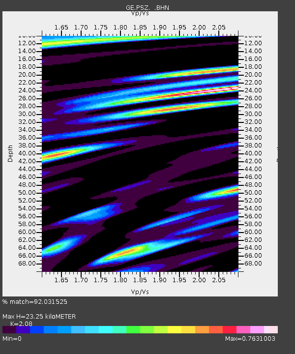
Estimated Moho Depth: 23.25 km
Estimated Crust Vp/Vs: 2.08
Assumed Crust Vp: 6.155 km/s
Estimated Crust Vs: 2.959 km/s
Estimated Crust Poisson's Ratio: 0.35
Radial Match: 92.031525 %
Radial Bump: 400
Transverse Match: 88.113625 %
Transverse Bump: 400
SOD ConfigId: 6273
Insert Time: 2010-03-09 03:58:08.168 +0000
GWidth: 2.5
Max Bumps: 400
Tol: 0.001

Signal To Noise

ChannelStoNSTALTA
GE:PSZ: :BHN:19961210T08:46:18.692004Z1.61052013.8324444E-72.3796316E-7
GE:PSZ: :BHE:19961210T08:46:18.679004Z1.15252483.1843064E-72.762896E-7
GE:PSZ: :BHZ:19961210T08:46:18.692004Z3.23309525.8063887E-71.7959226E-7
Arrivals
Ps4.2 SECOND
PpPs11 SECOND
PsPs/PpSs15 SECOND