You are here: Home > Network List > TA - USArray Transportable Network (new EarthScope stations) Stations List
> Station I30M Mount Dempster, Yukon, CAN > Earthquake Result Viewer
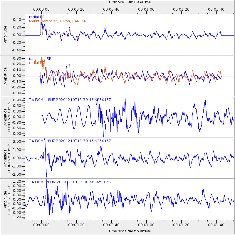
I30M Mount Dempster, Yukon, CAN - Earthquake Result Viewer
*The percent match for this event was below the threshold and hence no stack was calculated.
| Earthquake location: |
Taiwan Region |
| Earthquake latitude/longitude: |
24.8/122.0 |
| Earthquake time(UTC): |
2020/12/10 (345) 13:19:58 GMT |
| Earthquake Depth: |
73 km |
| Earthquake Magnitude: |
6.1 mww |
| Earthquake Catalog/Contributor: |
NEIC PDE/us |
|
| Network: |
TA USArray Transportable Network (new EarthScope stations) |
| Station: |
I30M Mount Dempster, Yukon, CAN |
| Lat/Lon: |
65.22 N/136.38 W |
| Elevation: |
1399 m |
|
| Distance: |
72.5 deg |
| Az: |
25.646 deg |
| Baz: |
290.982 deg |
| Ray Param: |
$rayparam |
*The percent match for this event was below the threshold and hence was not used in the summary stack. |
|
| Radial Match: |
62.591354 % |
| Radial Bump: |
400 |
| Transverse Match: |
49.296764 % |
| Transverse Bump: |
400 |
| SOD ConfigId: |
23341671 |
| Insert Time: |
2020-12-24 14:35:39.270 +0000 |
| GWidth: |
2.5 |
| Max Bumps: |
400 |
| Tol: |
0.001 |
|
Signal To Noise
| Channel | StoN | STA | LTA |
| TA:I30M: :BHZ:20201210T13:30:46.925015Z | 5.9911103 | 1.0287195E-6 | 1.7170765E-7 |
| TA:I30M: :BHN:20201210T13:30:46.925015Z | 1.8315227 | 4.838636E-7 | 2.641865E-7 |
| TA:I30M: :BHE:20201210T13:30:46.925015Z | 1.6105615 | 4.799843E-7 | 2.9802297E-7 |
| Arrivals |
| Ps | |
| PpPs | |
| PsPs/PpSs | |


