PSZ GKKI/GEOFON Station Piszkes, Hungary - Earthquake Result Viewer
Earthquake location: Off East Coast Of Kamchatka
Earthquake latitude/longitude: 52.9/160.1
Earthquake time(UTC): 1998/06/01 (152) 05:34:03 GMT
Earthquake Depth: 44 km
Earthquake Magnitude: 6.2 MB, 6.3 MS, 6.5 UNKNOWN, 6.4 MW
Earthquake Catalog/Contributor: WHDF/NEIC
Network: GE GEOFON
Station: PSZ GKKI/GEOFON Station Piszkes, Hungary
Lat/Lon: 47.92 N/19.89 E
Elevation: 940 m
Distance: 74.0 deg
Az: 333.373 deg
Baz: 23.811 deg
Ray Param: 0.052548632
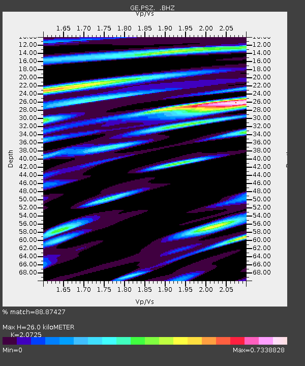
Estimated Moho Depth: 26.0 km
Estimated Crust Vp/Vs: 2.07
Assumed Crust Vp: 6.155 km/s
Estimated Crust Vs: 2.97 km/s
Estimated Crust Poisson's Ratio: 0.35
Radial Match: 88.87427 %
Radial Bump: 400
Transverse Match: 88.69224 %
Transverse Bump: 400
SOD ConfigId: 4480
Insert Time: 2010-03-09 03:58:33.250 +0000
GWidth: 2.5
Max Bumps: 400
Tol: 0.001

Signal To Noise

ChannelStoNSTALTA
GE:PSZ: :BHZ:19980601T05:45:03.578003Z89.0144654.3045375E-64.835773E-8
GE:PSZ: :BHN:19980601T05:45:03.578003Z35.764741.5066227E-64.2125926E-8
GE:PSZ: :BHE:19980601T05:45:03.578003Z25.6951779.866463E-73.8398117E-8
Arrivals
Ps4.7 SECOND
PpPs13 SECOND
PsPs/PpSs17 SECOND