You are here: Home > Network List > TA - USArray Transportable Network (new EarthScope stations) Stations List
> Station R33M Jennings River, BC, CAN > Earthquake Result Viewer
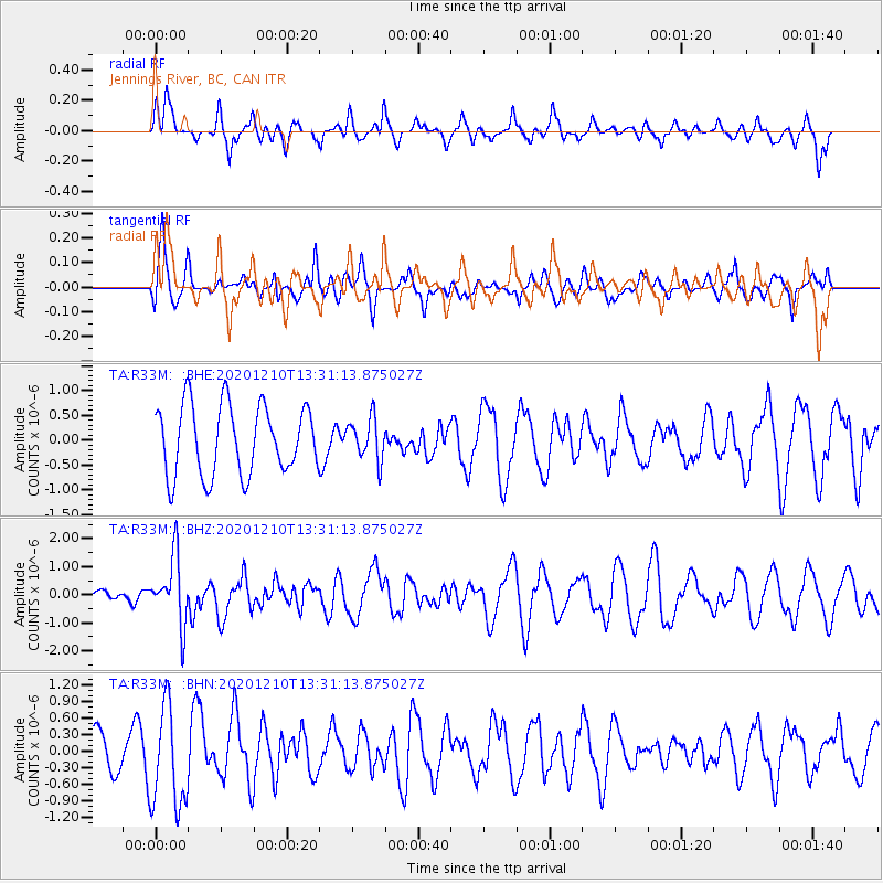
R33M Jennings River, BC, CAN - Earthquake Result Viewer
*The percent match for this event was below the threshold and hence no stack was calculated.
| Earthquake location: |
Taiwan Region |
| Earthquake latitude/longitude: |
24.8/122.0 |
| Earthquake time(UTC): |
2020/12/10 (345) 13:19:58 GMT |
| Earthquake Depth: |
73 km |
| Earthquake Magnitude: |
6.1 mww |
| Earthquake Catalog/Contributor: |
NEIC PDE/us |
|
| Network: |
TA USArray Transportable Network (new EarthScope stations) |
| Station: |
R33M Jennings River, BC, CAN |
| Lat/Lon: |
59.39 N/130.97 W |
| Elevation: |
1437 m |
|
| Distance: |
77.2 deg |
| Az: |
30.114 deg |
| Baz: |
296.941 deg |
| Ray Param: |
$rayparam |
*The percent match for this event was below the threshold and hence was not used in the summary stack. |
|
| Radial Match: |
59.222702 % |
| Radial Bump: |
400 |
| Transverse Match: |
45.748547 % |
| Transverse Bump: |
376 |
| SOD ConfigId: |
23341671 |
| Insert Time: |
2020-12-24 14:36:16.962 +0000 |
| GWidth: |
2.5 |
| Max Bumps: |
400 |
| Tol: |
0.001 |
|
Signal To Noise
| Channel | StoN | STA | LTA |
| TA:R33M: :BHZ:20201210T13:31:13.875027Z | 4.0752516 | 1.186869E-6 | 2.912382E-7 |
| TA:R33M: :BHN:20201210T13:31:13.875027Z | 2.4554505 | 9.216222E-7 | 3.7533732E-7 |
| TA:R33M: :BHE:20201210T13:31:13.875027Z | 0.59887433 | 4.168931E-7 | 6.9612787E-7 |
| Arrivals |
| Ps | |
| PpPs | |
| PsPs/PpSs | |


