You are here: Home > Network List > US - United States National Seismic Network Stations List
> Station DGMT Dagmar, Montana, USA > Earthquake Result Viewer
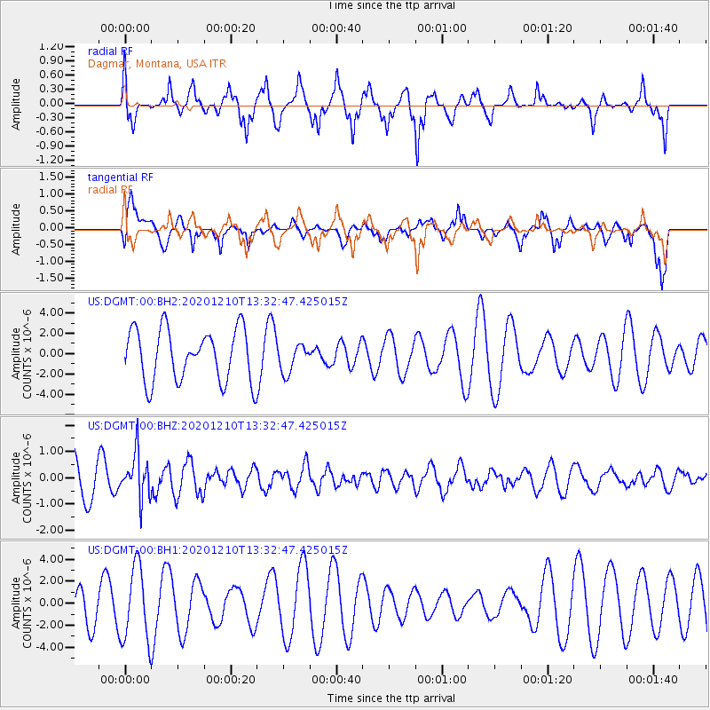
DGMT Dagmar, Montana, USA - Earthquake Result Viewer
*The percent match for this event was below the threshold and hence no stack was calculated.
| Earthquake location: |
Taiwan Region |
| Earthquake latitude/longitude: |
24.8/122.0 |
| Earthquake time(UTC): |
2020/12/10 (345) 13:19:58 GMT |
| Earthquake Depth: |
73 km |
| Earthquake Magnitude: |
6.1 mww |
| Earthquake Catalog/Contributor: |
NEIC PDE/us |
|
| Network: |
US United States National Seismic Network |
| Station: |
DGMT Dagmar, Montana, USA |
| Lat/Lon: |
48.47 N/104.20 W |
| Elevation: |
0.0 m |
|
| Distance: |
96.2 deg |
| Az: |
28.894 deg |
| Baz: |
318.695 deg |
| Ray Param: |
$rayparam |
*The percent match for this event was below the threshold and hence was not used in the summary stack. |
|
| Radial Match: |
78.072754 % |
| Radial Bump: |
400 |
| Transverse Match: |
63.06103 % |
| Transverse Bump: |
400 |
| SOD ConfigId: |
23341671 |
| Insert Time: |
2020-12-24 14:37:18.791 +0000 |
| GWidth: |
2.5 |
| Max Bumps: |
400 |
| Tol: |
0.001 |
|
Signal To Noise
| Channel | StoN | STA | LTA |
| US:DGMT:00:BHZ:20201210T13:32:47.425015Z | 0.78725487 | 8.6895574E-7 | 1.1037795E-6 |
| US:DGMT:00:BH1:20201210T13:32:47.425015Z | 2.2946005 | 3.407519E-6 | 1.4850164E-6 |
| US:DGMT:00:BH2:20201210T13:32:47.425015Z | 0.5511789 | 1.4020509E-6 | 2.5437312E-6 |
| Arrivals |
| Ps | |
| PpPs | |
| PsPs/PpSs | |


