You are here: Home > Network List > WY - Yellowstone Wyoming Seismic Network Stations List
> Station YHH Holmes Hill, YNP, WY, USA > Earthquake Result Viewer
YHH Holmes Hill, YNP, WY, USA - Earthquake Result Viewer
*The percent match for this event was below the threshold and hence no stack was calculated.
| Earthquake location: |
Taiwan Region |
| Earthquake latitude/longitude: |
24.8/122.0 |
| Earthquake time(UTC): |
2020/12/10 (345) 13:19:58 GMT |
| Earthquake Depth: |
73 km |
| Earthquake Magnitude: |
6.1 mww |
| Earthquake Catalog/Contributor: |
NEIC PDE/us |
|
| Network: |
WY Yellowstone Wyoming Seismic Network |
| Station: |
YHH Holmes Hill, YNP, WY, USA |
| Lat/Lon: |
44.79 N/110.85 W |
| Elevation: |
2717 m |
|
| Distance: |
95.6 deg |
| Az: |
34.779 deg |
| Baz: |
313.26 deg |
| Ray Param: |
$rayparam |
*The percent match for this event was below the threshold and hence was not used in the summary stack. |
|
| Radial Match: |
76.37657 % |
| Radial Bump: |
387 |
| Transverse Match: |
85.798195 % |
| Transverse Bump: |
259 |
| SOD ConfigId: |
23341671 |
| Insert Time: |
2020-12-24 14:39:00.082 +0000 |
| GWidth: |
2.5 |
| Max Bumps: |
400 |
| Tol: |
0.001 |
|
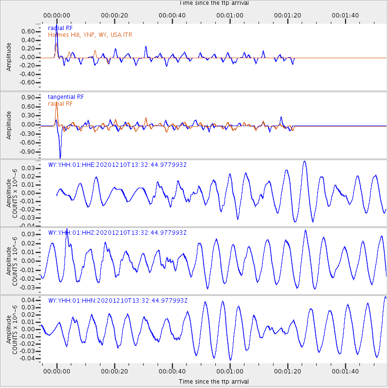
Signal To Noise
| Channel | StoN | STA | LTA |
| WY:YHH:01:HHZ:20201210T13:32:44.977993Z | 1.6909932 | 1.9165672E-8 | 1.1333973E-8 |
| WY:YHH:01:HHN:20201210T13:32:44.977993Z | 0.91213465 | 1.0391636E-8 | 1.1392655E-8 |
| WY:YHH:01:HHE:20201210T13:32:44.977993Z | 0.8709974 | 7.2736928E-9 | 8.350992E-9 |
| Arrivals |
| Ps | |
| PpPs | |
| PsPs/PpSs | |


