You are here: Home > Network List > HV - Hawaiian Volcano Observatory Network Stations List
> Station MLOD Mauna Loa, Hawaii Digital > Earthquake Result Viewer
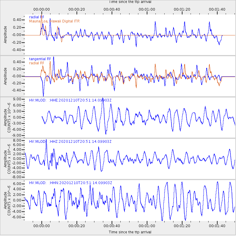
MLOD Mauna Loa, Hawaii Digital - Earthquake Result Viewer
*The percent match for this event was below the threshold and hence no stack was calculated.
| Earthquake location: |
South Of Kermadec Islands |
| Earthquake latitude/longitude: |
-33.0/-179.8 |
| Earthquake time(UTC): |
2020/12/10 (345) 20:42:06 GMT |
| Earthquake Depth: |
83 km |
| Earthquake Magnitude: |
6.0 Mww |
| Earthquake Catalog/Contributor: |
NEIC PDE/us |
|
| Network: |
HV Hawaiian Volcano Observatory Network |
| Station: |
MLOD Mauna Loa, Hawaii Digital |
| Lat/Lon: |
19.49 N/155.39 W |
| Elevation: |
2044 m |
|
| Distance: |
57.1 deg |
| Az: |
27.612 deg |
| Baz: |
204.391 deg |
| Ray Param: |
$rayparam |
*The percent match for this event was below the threshold and hence was not used in the summary stack. |
|
| Radial Match: |
52.21071 % |
| Radial Bump: |
380 |
| Transverse Match: |
64.60955 % |
| Transverse Bump: |
400 |
| SOD ConfigId: |
23341671 |
| Insert Time: |
2020-12-24 21:49:20.919 +0000 |
| GWidth: |
2.5 |
| Max Bumps: |
400 |
| Tol: |
0.001 |
|
Signal To Noise
| Channel | StoN | STA | LTA |
| HV:MLOD: :HHZ:20201210T20:51:14.09903Z | 1.413407 | 3.1736874E-6 | 2.2454167E-6 |
| HV:MLOD: :HHN:20201210T20:51:14.09903Z | 0.7595445 | 2.3558612E-6 | 3.1016764E-6 |
| HV:MLOD: :HHE:20201210T20:51:14.09903Z | 2.1585944 | 4.6786035E-6 | 2.1674307E-6 |
| Arrivals |
| Ps | |
| PpPs | |
| PsPs/PpSs | |


