You are here: Home > Network List > CI - Caltech Regional Seismic Network Stations List
> Station MPM Manuel Prospect Mine, California, USA > Earthquake Result Viewer
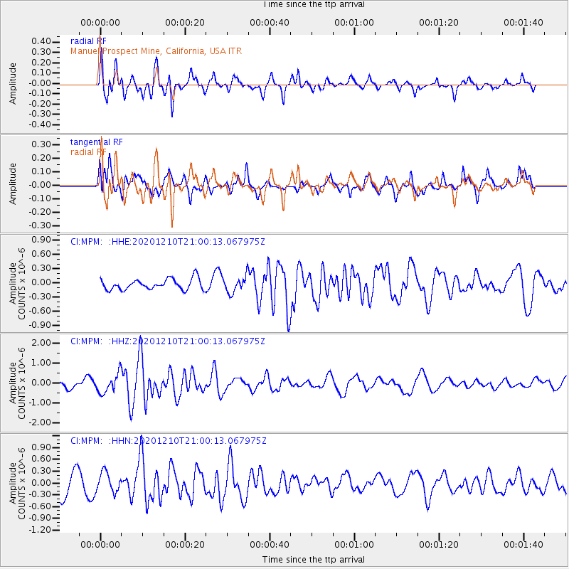
MPM Manuel Prospect Mine, California, USA - Earthquake Result Viewer
*The percent match for this event was below the threshold and hence no stack was calculated.
| Earthquake location: |
Tonga Islands |
| Earthquake latitude/longitude: |
-17.6/-174.9 |
| Earthquake time(UTC): |
2020/12/10 (345) 20:48:56 GMT |
| Earthquake Depth: |
10 km |
| Earthquake Magnitude: |
5.9 mb |
| Earthquake Catalog/Contributor: |
NEIC PDE/us |
|
| Network: |
CI Caltech Regional Seismic Network |
| Station: |
MPM Manuel Prospect Mine, California, USA |
| Lat/Lon: |
36.06 N/117.49 W |
| Elevation: |
185 m |
|
| Distance: |
76.0 deg |
| Az: |
44.678 deg |
| Baz: |
235.877 deg |
| Ray Param: |
$rayparam |
*The percent match for this event was below the threshold and hence was not used in the summary stack. |
|
| Radial Match: |
70.40588 % |
| Radial Bump: |
400 |
| Transverse Match: |
62.434067 % |
| Transverse Bump: |
400 |
| SOD ConfigId: |
23341671 |
| Insert Time: |
2020-12-24 22:00:01.416 +0000 |
| GWidth: |
2.5 |
| Max Bumps: |
400 |
| Tol: |
0.001 |
|
Signal To Noise
| Channel | StoN | STA | LTA |
| CI:MPM: :HHZ:20201210T21:00:13.067975Z | 4.0325828 | 4.844701E-7 | 1.2013892E-7 |
| CI:MPM: :HHN:20201210T21:00:13.067975Z | 1.1292033 | 2.5759593E-7 | 2.2812185E-7 |
| CI:MPM: :HHE:20201210T21:00:13.067975Z | 1.5303925 | 1.7398926E-7 | 1.136893E-7 |
| Arrivals |
| Ps | |
| PpPs | |
| PsPs/PpSs | |


